

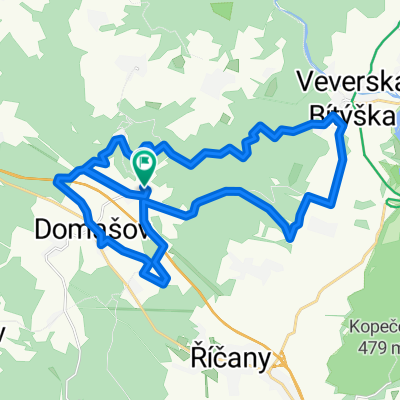
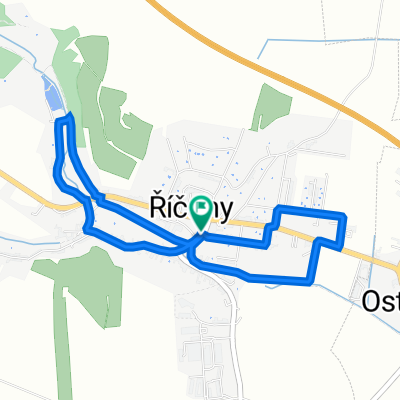
Bílý potok
A cycling route starting in Říčany, South Moravian, Czechia.
Overview
About this route
- -:--
- Duration
- 33.3 km
- Distance
- 373 m
- Ascent
- 547 m
- Descent
- ---
- Avg. speed
- ---
- Avg. speed
Route quality
Waytypes & surfaces along the route
Waytypes
Track
17.3 km
(52 %)
Quiet road
7.5 km
(23 %)
Surfaces
Paved
11.9 km
(36 %)
Unpaved
13.5 km
(41 %)
Asphalt
11.3 km
(34 %)
Ground
9.9 km
(30 %)
Continue with Bikemap
Use, edit, or download this cycling route
You would like to ride Bílý potok or customize it for your own trip? Here is what you can do with this Bikemap route:
Free features
- Save this route as favorite or in collections
- Copy & plan your own version of this route
- Sync your route with Garmin or Wahoo
Premium features
Free trial for 3 days, or one-time payment. More about Bikemap Premium.
- Navigate this route on iOS & Android
- Export a GPX / KML file of this route
- Create your custom printout (try it for free)
- Download this route for offline navigation
Discover more Premium features.
Get Bikemap PremiumFrom our community
Other popular routes starting in Říčany
 Tour de Javůrek
- Distance
- 30.9 km
- Ascent
- 463 m
- Descent
- 463 m
- Location
- Říčany, South Moravian, Czechia
 maraton pells
- Distance
- 58.8 km
- Ascent
- 1,104 m
- Descent
- 1,013 m
- Location
- Říčany, South Moravian, Czechia
 Rosická 141, Říčany to Rosická 141, Říčany
- Distance
- 4.3 km
- Ascent
- 42 m
- Descent
- 52 m
- Location
- Říčany, South Moravian, Czechia
 Říčky - V. Bitýška - Veveří - žlutá - Bystrc - Farinka - Bosonohy - Troubsko
- Distance
- 39.1 km
- Ascent
- 400 m
- Descent
- 580 m
- Location
- Říčany, South Moravian, Czechia
 Ostrovacice, Tchequie / Nové Město na Moravě, Tchequie
- Distance
- 74.4 km
- Ascent
- 772 m
- Descent
- 514 m
- Location
- Říčany, South Moravian, Czechia
 Z Říček údolím Chvojnice, Oslavy, Jihlavy a Bobravy
- Distance
- 87.2 km
- Ascent
- 665 m
- Descent
- 665 m
- Location
- Říčany, South Moravian, Czechia
 ME 2013 TT U23
- Distance
- 26.9 km
- Ascent
- 389 m
- Descent
- 390 m
- Location
- Říčany, South Moravian, Czechia
 02.09.17
- Distance
- 44.6 km
- Ascent
- 942 m
- Descent
- 942 m
- Location
- Říčany, South Moravian, Czechia
Open it in the app