

Wodantal-Nierenhof-Hattingen-Sprockhövel-Gevelsberg-Wuppertal
A cycling route starting in Schwelm, North Rhine-Westphalia, Germany.
Overview
About this route
- -:--
- Duration
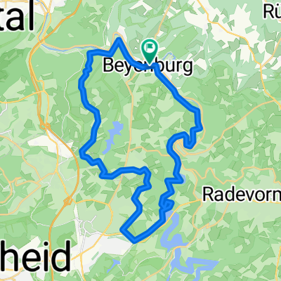
- 44.5 km
- Distance
- 490 m
- Ascent
- 486 m
- Descent
- ---
- Avg. speed
- ---
- Avg. speed

Route quality
Waytypes & surfaces along the route
Waytypes
Busy road
36.7 km
(82 %)
Road
3.6 km
(8 %)
Surfaces
Paved
44.3 km
(100 %)
Unpaved
0.2 km
(<1 %)
Asphalt
43 km
(97 %)
Paving stones
1.2 km
(3 %)
Continue with Bikemap
Use, edit, or download this cycling route
You would like to ride Wodantal-Nierenhof-Hattingen-Sprockhövel-Gevelsberg-Wuppertal or customize it for your own trip? Here is what you can do with this Bikemap route:
Free features
- Save this route as favorite or in collections
- Copy & plan your own version of this route
- Sync your route with Garmin or Wahoo
Premium features
Free trial for 3 days, or one-time payment. More about Bikemap Premium.
- Navigate this route on iOS & Android
- Export a GPX / KML file of this route
- Create your custom printout (try it for free)
- Download this route for offline navigation
Discover more Premium features.
Get Bikemap PremiumFrom our community
Other popular routes starting in Schwelm
 Feierabend Route über Löhrerlen, Schee, Hasslinghausen, Gevelsberg
- Distance
- 23.3 km
- Ascent
- 156 m
- Descent
- 155 m
- Location
- Schwelm, North Rhine-Westphalia, Germany
 Schwelm,Königsfeld,Beyenburg,Langerfeld
- Distance
- 24.9 km
- Ascent
- 277 m
- Descent
- 277 m
- Location
- Schwelm, North Rhine-Westphalia, Germany
 Brunnenstraße, Schwelm nach Brunnenstraße, Schwelm
- Distance
- 33.5 km
- Ascent
- 439 m
- Descent
- 440 m
- Location
- Schwelm, North Rhine-Westphalia, Germany
 Rundweg2 Mufflon-Wildgehege
- Distance
- 1.7 km
- Ascent
- 54 m
- Descent
- 57 m
- Location
- Schwelm, North Rhine-Westphalia, Germany
 Baldeneysee über Dönberg
- Distance
- 66.9 km
- Ascent
- 989 m
- Descent
- 987 m
- Location
- Schwelm, North Rhine-Westphalia, Germany
 Rundtour Bergischer Panoramaweg, Start in Schwelm
- Distance
- 73.6 km
- Ascent
- 452 m
- Descent
- 455 m
- Location
- Schwelm, North Rhine-Westphalia, Germany
 Marscheider Bachtal – Wuppertalsperre Runde von Wuppertal-Langerfeld
- Distance
- 39.3 km
- Ascent
- 266 m
- Descent
- 277 m
- Location
- Schwelm, North Rhine-Westphalia, Germany
 Standardrunde von Frank und Frank
- Distance
- 27.5 km
- Ascent
- 531 m
- Descent
- 515 m
- Location
- Schwelm, North Rhine-Westphalia, Germany
Open it in the app