

Saar-Kanal-Kestastel
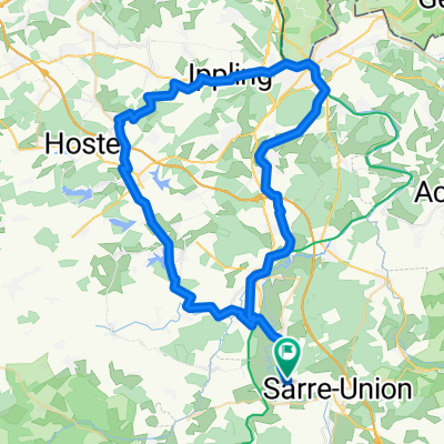
A cycling route starting in Keskastel, Alsace-Champagne-Ardenne-Lorraine, France.
Overview
About this route
Die Fahrt am Kanal ist flach, steigt aber stetig in Richtung Süden. Den Schiffen wird die Überwindung der Höhenmeter durch etliche Schleusen ermöglicht.
Dagegen ist die Strecke an der Saar entlang hügelig.
Deshalb empfiehlt sich zuerst an der Saar und dann entspannt am Kanal entlang zurück zu fahren.
Direkt an der Saar entlang gibt es keine durchgängigen Wege, auch keine unbefestigten :-(
- -:--
- Duration
- 73 km
- Distance
- 200 m
- Ascent
- 200 m
- Descent
- ---
- Avg. speed
- ---
- Avg. speed
Route quality
Waytypes & surfaces along the route
Waytypes
Cycleway
29.8 km
(41 %)
Busy road
23.4 km
(32 %)
Surfaces
Paved
58.2 km
(80 %)
Asphalt
40.7 km
(56 %)
Paved (undefined)
17.5 km
(24 %)
Undefined
14.8 km
(20 %)
Route highlights
Points of interest along the route
Point of interest after 19.3 km
Kein Lokal gefunden :-( Hier kann man die Tour nach Fénétrange abkürzen.
Point of interest after 40.7 km
Gute Bäckerei - unsere Rettung
Point of interest after 51.6 km
Point of interest after 68 km
Hier schließt sich der Kreis!
Continue with Bikemap
Use, edit, or download this cycling route
You would like to ride Saar-Kanal-Kestastel or customize it for your own trip? Here is what you can do with this Bikemap route:
Free features
- Save this route as favorite or in collections
- Copy & plan your own version of this route
- Sync your route with Garmin or Wahoo
Premium features
Free trial for 3 days, or one-time payment. More about Bikemap Premium.
- Navigate this route on iOS & Android
- Export a GPX / KML file of this route
- Create your custom printout (try it for free)
- Download this route for offline navigation
Discover more Premium features.
Get Bikemap PremiumFrom our community
Other popular routes starting in Keskastel
 Keskastel Dabo
- Distance
- 67.8 km
- Ascent
- 490 m
- Descent
- 248 m
- Location
- Keskastel, Alsace-Champagne-Ardenne-Lorraine, France
 Day 3: Keskastel - Saarlouis
- Distance
- 65.4 km
- Ascent
- 339 m
- Descent
- 380 m
- Location
- Keskastel, Alsace-Champagne-Ardenne-Lorraine, France
 16032017
- Distance
- 64.3 km
- Ascent
- 214 m
- Descent
- 214 m
- Location
- Keskastel, Alsace-Champagne-Ardenne-Lorraine, France
 harskirchen diedendorf 2
- Distance
- 23.2 km
- Ascent
- 174 m
- Descent
- 176 m
- Location
- Keskastel, Alsace-Champagne-Ardenne-Lorraine, France
 Rue de la Paix 14, Keskastel nach Elsässer Straße 34, Kleinblittersdorf
- Distance
- 35.2 km
- Ascent
- 374 m
- Descent
- 397 m
- Location
- Keskastel, Alsace-Champagne-Ardenne-Lorraine, France
 Voie Verte de Brienne-le-Château à Bar-sur-Seine, Sarralbe to Voie Verte de Brienne-le-Château à Bar-sur-Seine, Fribourg
- Distance
- 25.1 km
- Ascent
- 54 m
- Descent
- 3 m
- Location
- Keskastel, Alsace-Champagne-Ardenne-Lorraine, France
 09022017
- Distance
- 74.1 km
- Ascent
- 204 m
- Descent
- 206 m
- Location
- Keskastel, Alsace-Champagne-Ardenne-Lorraine, France
 De Rue du Lavoir 36, Keskastel à Rue du Lavoir 36, Keskastel
- Distance
- 11.2 km
- Ascent
- 85 m
- Descent
- 142 m
- Location
- Keskastel, Alsace-Champagne-Ardenne-Lorraine, France
Open it in the app