Premium Badge Download on the App Store Get it on Google Play Turn-by-turn Navigation Offline Maps Bike Type Optimized Routing Premium Maps Custom Bike Computer Export Routes Route Previews Fall Detection Premium Support

Cycling Route in Bevenrode, Lower Saxony, Germany

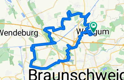
Waggum-Kanzlerfeld-Waggum

0
Open this route in the Bikemap app

Open this route in the Bikemap app

Open this route in Bikemap Web

Open this route in Bikemap Web

47 km
Distance
138 m
Ascent
140 m
Descent
-:-- h
Duration
-- km/h
Avg. Speed
--- m
Max. Elevation

About This Route

Mountainbikestrecke "Rund um die Stadtgrenze von Braunschweig"<br /><br />1. Teilstrecke Waggum - Kanzlerfeld<br /><br />Strecke führt überwiegend über Feld-, Wiesen- u. Waldwege u. z.T. mehreren Trails u. Pfade. Auf der Strecke gibt es mehrere kurze steile Anstiege/Gefällstrecken mit bis zu 25% Steigung oder Gefälle. Hauptstraßen werden nur z.T. kurz gekreuzt.<br /><br />Gesamtstrecke 47 km mit ca. 185 Hm

This cycling route is ideal for: MTB

You will cycle on the following surfaces: Paved Unpaved Gravel

Highlights Along The Route

Point of Interest

kurzer Trail an der Bienroder Kieskuhle mit einer kurzen Schiebepassage

Point of Interest

Pfad unter der A2 mit 25% Gefällestrecke zur Oker

Point of Interest

2,3km Trail, zu Anfang Bergabpassage mit schmaler Brückenüberfahrt, danach schneller kurviger Trail ( bester Trail bei Eickhorst)

More highlights are available with Bikemap for iOS and Android.

Customize this cycling route with the Bikemap route planner.

Make it yours!

Did you know? You can use this route as a template in our cycling route planner if you don't wish to start from scratch. Customize it based on your needs to plan your perfect cycling tour.

Open it in the app