

MAZURSKÁ JEZERA NA LODI A NA KOLE
A cycling route starting in Kruklanki, Warmian-Masurian Voivodeship, Poland.
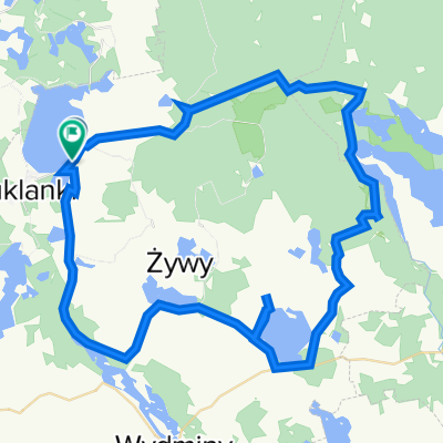
Overview
About this route
Na kole krajinou Mazurských jezer, jedním z nejmalebnějších míst Evropy, nazývaném „zelené plíce“ Polska. Dokonalými cyklostezkami po nefrekventovaných silničkách a cestách mezi tisíci jezer propojených kanály a říčkami, které vytvářejí ideální region pro mnoho druhů vzácné flóry a ptactva. Z paluby výletní lodě, na kole či na pronajaté jachtě můžeme obdivovat pralesy, chráněné vodní rostliny, rezervace zubrů a labutí. Uvidíme staropruská opevnění, zámky a kostely, křižácké hrady a opevnění, válečné bunkry a mnoho dalších historických krás tohoto regionu.www.nomad.cz
- -:--
- Duration
- 335 km
- Distance
- 272 m
- Ascent
- 309 m
- Descent
- ---
- Avg. speed
- ---
- Avg. speed

Route highlights
Points of interest along the route
Point of interest after 0.2 km
Lipowo
Point of interest after 0.9 km
Borecký prales
Point of interest after 1.8 km
Wolisko
Point of interest after 25.3 km
Spytkovo
Point of interest after 29.9 km
Giżycko
Point of interest after 88.7 km
jezero Dargin
Point of interest after 100.2 km
Pozezdrze
Point of interest after 112.7 km
jezero Mamry
Point of interest after 115.2 km
Hitlerovo Vlčí doupě
Point of interest after 148.9 km
Gorazdovo
Point of interest after 156.6 km
Monetki
Point of interest after 172 km
Orlo
Point of interest after 185.8 km
Nakomiady
Point of interest after 188.8 km
Owczarki
Point of interest after 236.1 km
vyhlídková cesta pronajatou lodí po jezerech do Mikolajki
Point of interest after 266.7 km
Mikolajky
Point of interest after 275.8 km
jezero Lisunie
Point of interest after 308.5 km
Okartowo
Point of interest after 312.2 km
Nowe Guty
Point of interest after 325.9 km
Karwik
Continue with Bikemap
Use, edit, or download this cycling route
You would like to ride MAZURSKÁ JEZERA NA LODI A NA KOLE or customize it for your own trip? Here is what you can do with this Bikemap route:
Free features
- Save this route as favorite or in collections
- Copy & plan your own version of this route
- Sync your route with Garmin or Wahoo
Premium features
Free trial for 3 days, or one-time payment. More about Bikemap Premium.
- Navigate this route on iOS & Android
- Export a GPX / KML file of this route
- Create your custom printout (try it for free)
- Download this route for offline navigation
Discover more Premium features.
Get Bikemap PremiumFrom our community
Other popular routes starting in Kruklanki
 Kruklanki,Jez.Krzywa Kuta,Kruklani-27,894 km
- Distance
- 27.9 km
- Ascent
- 170 m
- Descent
- 170 m
- Location
- Kruklanki, Warmian-Masurian Voivodeship, Poland
 Mazury_2016
- Distance
- 244 km
- Ascent
- 312 m
- Descent
- 314 m
- Location
- Kruklanki, Warmian-Masurian Voivodeship, Poland
 Goldapiwo-petla wschodnia
- Distance
- 61.2 km
- Ascent
- 470 m
- Descent
- 471 m
- Location
- Kruklanki, Warmian-Masurian Voivodeship, Poland
 Stańczyki dzień III , Kruklanki-Kętrzyn
- Distance
- 44.4 km
- Ascent
- 161 m
- Descent
- 197 m
- Location
- Kruklanki, Warmian-Masurian Voivodeship, Poland
 Goldapiwo-sluza
- Distance
- 22.1 km
- Ascent
- 183 m
- Descent
- 184 m
- Location
- Kruklanki, Warmian-Masurian Voivodeship, Poland
 Jasieniec nach Dąbrowskiego 8, Giżycko
- Distance
- 18.2 km
- Ascent
- 97 m
- Descent
- 115 m
- Location
- Kruklanki, Warmian-Masurian Voivodeship, Poland
 Dzień 7
- Distance
- 62 km
- Ascent
- 195 m
- Descent
- 226 m
- Location
- Kruklanki, Warmian-Masurian Voivodeship, Poland
 Stańczyki dzień II
- Distance
- 144.4 km
- Ascent
- 435 m
- Descent
- 419 m
- Location
- Kruklanki, Warmian-Masurian Voivodeship, Poland
Open it in the app