

Training-Eisenberg
A cycling route starting in Münchenbernsdorf, Free State of Thuringia, Germany.
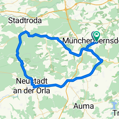
Overview
About this route
sehr viel Straße, teils B7 bis nach Jena, Saaletradweg bis Stadtroda
- -:--
- Duration
- 79.8 km
- Distance
- 454 m
- Ascent
- 454 m
- Descent
- ---
- Avg. speed
- ---
- Avg. speed

Route quality
Waytypes & surfaces along the route
Waytypes
Busy road
45.8 km
(57 %)
Quiet road
11.6 km
(15 %)
Surfaces
Paved
71.2 km
(89 %)
Unpaved
1.2 km
(2 %)
Asphalt
65 km
(81 %)
Paving stones
5.5 km
(7 %)
Continue with Bikemap
Use, edit, or download this cycling route
You would like to ride Training-Eisenberg or customize it for your own trip? Here is what you can do with this Bikemap route:
Free features
- Save this route as favorite or in collections
- Copy & plan your own version of this route
- Sync your route with Garmin or Wahoo
Premium features
Free trial for 3 days, or one-time payment. More about Bikemap Premium.
- Navigate this route on iOS & Android
- Export a GPX / KML file of this route
- Create your custom printout (try it for free)
- Download this route for offline navigation
Discover more Premium features.
Get Bikemap PremiumFrom our community
Other popular routes starting in Münchenbernsdorf
 Winterstrecke (kurz)
- Distance
- 57.6 km
- Ascent
- 455 m
- Descent
- 435 m
- Location
- Münchenbernsdorf, Free State of Thuringia, Germany
 Training(Neustadt-Stadtroda-Klosterlausnitz-Kraftsdorf-St. Gangloff-Münchenbernsdorf)
- Distance
- 119 km
- Ascent
- 824 m
- Descent
- 823 m
- Location
- Münchenbernsdorf, Free State of Thuringia, Germany
 Münchenbernsdorf-Leegebruch 2013
- Distance
- 282.1 km
- Ascent
- 291 m
- Descent
- 578 m
- Location
- Münchenbernsdorf, Free State of Thuringia, Germany
 Münchenbernsdorf- Remptendorf
- Distance
- 56.3 km
- Ascent
- 532 m
- Descent
- 399 m
- Location
- Münchenbernsdorf, Free State of Thuringia, Germany
 Zeulenroda-Landschaftsausflug
- Distance
- 69.9 km
- Ascent
- 575 m
- Descent
- 575 m
- Location
- Münchenbernsdorf, Free State of Thuringia, Germany
 Pfingstrunde
- Distance
- 38.2 km
- Ascent
- 255 m
- Descent
- 256 m
- Location
- Münchenbernsdorf, Free State of Thuringia, Germany
 ndp ffw
- Distance
- 8.2 km
- Ascent
- 53 m
- Descent
- 86 m
- Location
- Münchenbernsdorf, Free State of Thuringia, Germany
 Münchenbernsdorf - Via Claudia Augusta
- Distance
- 369 km
- Ascent
- 1,383 m
- Descent
- 1,297 m
- Location
- Münchenbernsdorf, Free State of Thuringia, Germany
Open it in the app