

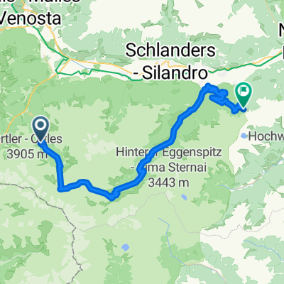
Stilfser Alm
A cycling route starting in Stilfs, Trentino-Alto Adige, Italy.
Overview
About this route
The starting point of this tour is the Silfser sports field with parking available. From there, follow the paved road uphill to the left-hand bend 1. Now follow the road along the signpost 'Stilfser Alm, Valatsches'. At the first left-hand bend begins a gravel road that takes you uphill through several hairpins to the Lower Stilfser Alm and further to the Upper Stilfser Alm. After a break, the descent is along the same route.
- -:--
- Duration
- 7.4 km
- Distance
- 882 m
- Ascent
- 180 m
- Descent
- ---
- Avg. speed
- ---
- Max. altitude
Continue with Bikemap
Use, edit, or download this cycling route
You would like to ride Stilfser Alm or customize it for your own trip? Here is what you can do with this Bikemap route:
Free features
- Save this route as favorite or in collections
- Copy & plan your own version of this route
- Sync your route with Garmin or Wahoo
Premium features
Free trial for 3 days, or one-time payment. More about Bikemap Premium.
- Navigate this route on iOS & Android
- Export a GPX / KML file of this route
- Create your custom printout (try it for free)
- Download this route for offline navigation
Discover more Premium features.
Get Bikemap PremiumFrom our community
Other popular routes starting in Stilfs
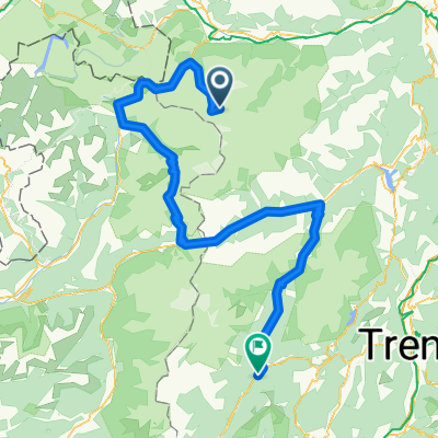
 Transalp 2015 Etappe 4 real.gpx
- Distance
- 51.1 km
- Ascent
- 2,404 m
- Descent
- 2,306 m
- Location
- Stilfs, Trentino-Alto Adige, Italy
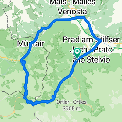
 Stelvio
- Distance
- 89.8 km
- Ascent
- 3,349 m
- Descent
- 1,926 m
- Location
- Stilfs, Trentino-Alto Adige, Italy
 Stilfser Joch
- Distance
- 65 km
- Ascent
- 1,887 m
- Descent
- 1,880 m
- Location
- Stilfs, Trentino-Alto Adige, Italy
 5.TagAlpx2018
- Distance
- 47.8 km
- Ascent
- 1,556 m
- Descent
- 1,982 m
- Location
- Stilfs, Trentino-Alto Adige, Italy
 Stilfser Alm
- Distance
- 7.4 km
- Ascent
- 882 m
- Descent
- 180 m
- Location
- Stilfs, Trentino-Alto Adige, Italy
 Gomagoi - Passo Stelvio - Dreisprachenspitze - Bormio
- Distance
- 39 km
- Ascent
- 1,554 m
- Descent
- 1,601 m
- Location
- Stilfs, Trentino-Alto Adige, Italy
 Tione di Trento - Rifugio Madriccio
- Distance
- 184 km
- Ascent
- 4,153 m
- Descent
- 6,315 m
- Location
- Stilfs, Trentino-Alto Adige, Italy
 Transalp Etappe 4
- Distance
- 52.9 km
- Ascent
- 2,587 m
- Descent
- 2,313 m
- Location
- Stilfs, Trentino-Alto Adige, Italy
Open it in the app