

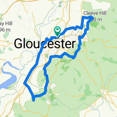
Frocester, Whiteshill, Upton, Great Witcombe, Cleeve
A cycling route starting in Churchdown, England, United Kingdom.
Overview
About this route
- -:--
- Duration
- 92.9 km
- Distance
- 943 m
- Ascent
- 867 m
- Descent
- ---
- Avg. speed
- 296 m
- Max. altitude

Route quality
Waytypes & surfaces along the route
Waytypes
Busy road
33.1 km
(36 %)
Road
24.8 km
(27 %)
Surfaces
Paved
46.3 km
(50 %)
Unpaved
2.1 km
(2 %)
Asphalt
44.3 km
(48 %)
Paved (undefined)
2 km
(2 %)
Continue with Bikemap
Use, edit, or download this cycling route
You would like to ride Frocester, Whiteshill, Upton, Great Witcombe, Cleeve or customize it for your own trip? Here is what you can do with this Bikemap route:
Free features
- Save this route as favorite or in collections
- Copy & plan your own version of this route
- Split it into stages to create a multi-day tour
- Sync your route with Garmin or Wahoo
Premium features
Free trial for 3 days, or one-time payment. More about Bikemap Premium.
- Navigate this route on iOS & Android
- Export a GPX / KML file of this route
- Create your custom printout (try it for free)
- Download this route for offline navigation
Discover more Premium features.
Get Bikemap PremiumFrom our community
Other popular routes starting in Churchdown
 Hartley lane loop
- Distance
- 30.2 km
- Ascent
- 350 m
- Descent
- 338 m
- Location
- Churchdown, England, United Kingdom
 North of Gloucester
- Distance
- 65.6 km
- Ascent
- 230 m
- Descent
- 233 m
- Location
- Churchdown, England, United Kingdom
 Churchdown to Pump House
- Distance
- 10.5 km
- Ascent
- 53 m
- Descent
- 33 m
- Location
- Churchdown, England, United Kingdom
 Over, Elton, Cinderford, Lea, Newent, Highnam
- Distance
- 73.9 km
- Ascent
- 498 m
- Descent
- 497 m
- Location
- Churchdown, England, United Kingdom
 Frocester, Whiteshill, Upton, Great Witcombe, Cleeve
- Distance
- 92.9 km
- Ascent
- 943 m
- Descent
- 867 m
- Location
- Churchdown, England, United Kingdom
 Fiddlers Elbow, Cranham, Fiddlers Elbow
- Distance
- 31 km
- Ascent
- 447 m
- Descent
- 440 m
- Location
- Churchdown, England, United Kingdom
 Boddington loop, home via Combe hill
- Distance
- 21.3 km
- Ascent
- 42 m
- Descent
- 43 m
- Location
- Churchdown, England, United Kingdom
 Slow ride in Gloucester
- Distance
- 0.3 km
- Ascent
- 0 m
- Descent
- 0 m
- Location
- Churchdown, England, United Kingdom
Open it in the app