

Retterschwanger Tal (MTB)
A cycling route starting in Immenstadt im Allgäu, Bavaria, Germany.
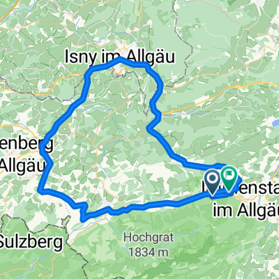
Overview
About this route
Ganz weit draußen: Ein anstrengender, aber schöner Ausflug in eines der idyllischsten Seitentäler des Oberallgäus. Auf Asphalt geht's über die Strausbergalpe bis kurz vor der oberen Straußbergalpe. Dann führt ein schmaler Schotterweg auf den Straußbergsattel. Jenseits des Sattels führt ein schmaler Waldweg ins Retterschwanger Tal. Der Weg zur Oberen Entschenalp beginnt gemütlich, wird gegen Schluß aber richtig knackig. Oben wartet eine phantastisch karge Bergidylle und die Gewißheit, daß sich die ganze Quälerei gelohnt hat. Runter gehts auf Asphalt und ein letztes Stückchen Waldweg bis ins Ostrachtal
- -:--
- Duration
- 54.3 km
- Distance
- 893 m
- Ascent
- 893 m
- Descent
- ---
- Avg. speed
- ---
- Avg. speed
Route highlights
Points of interest along the route
Point of interest after 18 km
Straußberg-Alpe
Point of interest after 20.1 km
Obere Straußberg-Alpe
Point of interest after 26.4 km
Obere Entschenalpe
Continue with Bikemap
Use, edit, or download this cycling route
You would like to ride Retterschwanger Tal (MTB) or customize it for your own trip? Here is what you can do with this Bikemap route:
Free features
- Save this route as favorite or in collections
- Copy & plan your own version of this route
- Sync your route with Garmin or Wahoo
Premium features
Free trial for 3 days, or one-time payment. More about Bikemap Premium.
- Navigate this route on iOS & Android
- Export a GPX / KML file of this route
- Create your custom printout (try it for free)
- Download this route for offline navigation
Discover more Premium features.
Get Bikemap PremiumFrom our community
Other popular routes starting in Immenstadt im Allgäu
 Alpsee MTB Runde
- Distance
- 20.9 km
- Ascent
- 592 m
- Descent
- 594 m
- Location
- Immenstadt im Allgäu, Bavaria, Germany
 Hauchenberg und Thaler Höhe mit Alpseeblick
- Distance
- 43.7 km
- Ascent
- 1,020 m
- Descent
- 1,021 m
- Location
- Immenstadt im Allgäu, Bavaria, Germany
 Salmaser und Thaler Höhe (MTB)
- Distance
- 25.2 km
- Ascent
- 654 m
- Descent
- 653 m
- Location
- Immenstadt im Allgäu, Bavaria, Germany
 Teil_2_bk-hotel-krone-immenstadt-ohlstadt-hotel-alpenblick
- Distance
- 119.9 km
- Ascent
- 722 m
- Descent
- 765 m
- Location
- Immenstadt im Allgäu, Bavaria, Germany
 Illerursprung
- Distance
- 42.3 km
- Ascent
- 193 m
- Descent
- 193 m
- Location
- Immenstadt im Allgäu, Bavaria, Germany
 Immenstadt- Gunzesried - Hittisau - Salmas - Alpsee
- Distance
- 62.4 km
- Ascent
- 1,256 m
- Descent
- 1,256 m
- Location
- Immenstadt im Allgäu, Bavaria, Germany
 Große Alpsee Runde
- Distance
- 70.1 km
- Ascent
- 808 m
- Descent
- 900 m
- Location
- Immenstadt im Allgäu, Bavaria, Germany
 Alpsee - Bodensee - Alpsee
- Distance
- 133.4 km
- Ascent
- 1,421 m
- Descent
- 1,593 m
- Location
- Immenstadt im Allgäu, Bavaria, Germany
Open it in the app