

Zell am See - Großglockner Hochalpenstraße - Heiligenblut - Lienz
A cycling route starting in Zell am See, Salzburg, Austria.
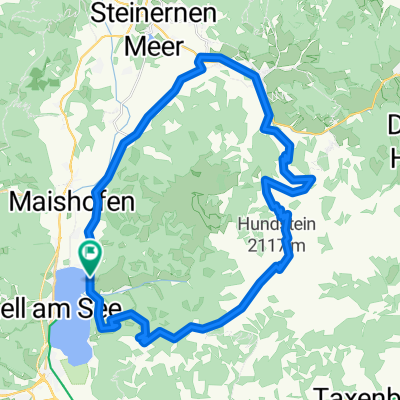
Overview
About this route
Das Dach von Österreich.
- -:--
- Duration
- 93.5 km
- Distance
- 2,171 m
- Ascent
- 2,250 m
- Descent
- ---
- Avg. speed
- ---
- Avg. speed

Route quality
Waytypes & surfaces along the route
Waytypes
Road
55.7 km
(60 %)
Busy road
31.4 km
(34 %)
Surfaces
Paved
80.8 km
(86 %)
Unpaved
0.1 km
(<1 %)
Asphalt
80.8 km
(86 %)
Unpaved (undefined)
0.1 km
(<1 %)
Continue with Bikemap
Use, edit, or download this cycling route
You would like to ride Zell am See - Großglockner Hochalpenstraße - Heiligenblut - Lienz or customize it for your own trip? Here is what you can do with this Bikemap route:
Free features
- Save this route as favorite or in collections
- Copy & plan your own version of this route
- Sync your route with Garmin or Wahoo
Premium features
Free trial for 3 days, or one-time payment. More about Bikemap Premium.
- Navigate this route on iOS & Android
- Export a GPX / KML file of this route
- Create your custom printout (try it for free)
- Download this route for offline navigation
Discover more Premium features.
Get Bikemap PremiumFrom our community
Other popular routes starting in Zell am See
 Ramseidner Runde
- Distance
- 55.5 km
- Ascent
- 691 m
- Descent
- 693 m
- Location
- Zell am See, Salzburg, Austria
 waldheim-enzianhuette_tour_174612738
- Distance
- 13.3 km
- Ascent
- 522 m
- Descent
- 519 m
- Location
- Zell am See, Salzburg, Austria
 Hundstein
- Distance
- 42 km
- Ascent
- 1,413 m
- Descent
- 1,413 m
- Location
- Zell am See, Salzburg, Austria
 Day 8: Zell am See to Munich
- Distance
- 186.4 km
- Ascent
- 2,043 m
- Descent
- 2,441 m
- Location
- Zell am See, Salzburg, Austria
 IRONMAN 70.3 Zell am See / Kaprun
- Distance
- 89.7 km
- Ascent
- 802 m
- Descent
- 804 m
- Location
- Zell am See, Salzburg, Austria
 Zell/See nach Heiligenblut am Großglockner
- Distance
- 53.7 km
- Ascent
- 2,471 m
- Descent
- 1,956 m
- Location
- Zell am See, Salzburg, Austria
 ZA3 Schmittenhöhe 31.7.2017
- Distance
- 39.3 km
- Ascent
- 1,392 m
- Descent
- 1,391 m
- Location
- Zell am See, Salzburg, Austria
 Zellerstraße, Zell am See nach Römerstraße, Untertauern
- Distance
- 108.4 km
- Ascent
- 3,144 m
- Descent
- 2,174 m
- Location
- Zell am See, Salzburg, Austria
Open it in the app