

Jeantex Tour Transalp 2007, 1. Etappe
A cycling route starting in Oberammergau, Bavaria, Germany.
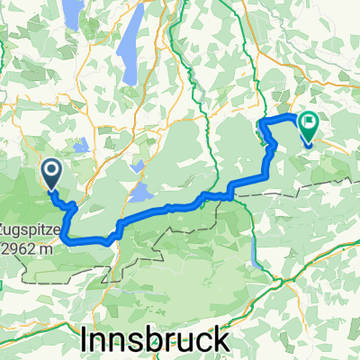
Overview
About this route
Ist nicht ganz genau, aber dennoch nachvollziehbar. War ne ganz schöne Quälerei!
- -:--
- Duration
- 107.8 km
- Distance
- 2,303 m
- Ascent
- 1,699 m
- Descent
- ---
- Avg. speed
- 1,443 m
- Avg. speed

Route quality
Waytypes & surfaces along the route
Waytypes
Busy road
84.4 km
(78 %)
Track
8.9 km
(8 %)
Surfaces
Paved
92.1 km
(85 %)
Unpaved
6.7 km
(6 %)
Asphalt
91.1 km
(84 %)
Gravel
2.7 km
(3 %)
Continue with Bikemap
Use, edit, or download this cycling route
You would like to ride Jeantex Tour Transalp 2007, 1. Etappe or customize it for your own trip? Here is what you can do with this Bikemap route:
Free features
- Save this route as favorite or in collections
- Copy & plan your own version of this route
- Sync your route with Garmin or Wahoo
Premium features
Free trial for 3 days, or one-time payment. More about Bikemap Premium.
- Navigate this route on iOS & Android
- Export a GPX / KML file of this route
- Create your custom printout (try it for free)
- Download this route for offline navigation
Discover more Premium features.
Get Bikemap PremiumFrom our community
Other popular routes starting in Oberammergau
 Ettalermandl Tour
- Distance
- 43.7 km
- Ascent
- 385 m
- Descent
- 382 m
- Location
- Oberammergau, Bavaria, Germany
 Ettaler Mandl - Drei-Marken
- Distance
- 42.8 km
- Ascent
- 1,071 m
- Descent
- 1,068 m
- Location
- Oberammergau, Bavaria, Germany
 Unternogg
- Distance
- 10.6 km
- Ascent
- 69 m
- Descent
- 69 m
- Location
- Oberammergau, Bavaria, Germany
 TAC 2012 Etappe 1: Oberammgergau-Imst
- Distance
- 95.3 km
- Ascent
- 1,619 m
- Descent
- 1,673 m
- Location
- Oberammergau, Bavaria, Germany
 Ettaler Manndl Bike & Hike
- Distance
- 14.7 km
- Ascent
- 803 m
- Descent
- 803 m
- Location
- Oberammergau, Bavaria, Germany
 Bayerntour 2009 Etappe 2
- Distance
- 111.2 km
- Ascent
- 1,084 m
- Descent
- 1,162 m
- Location
- Oberammergau, Bavaria, Germany
 Auf den Pürschling bei Oberammergau
- Distance
- 13 km
- Ascent
- 785 m
- Descent
- 787 m
- Location
- Oberammergau, Bavaria, Germany
 Ettal - Siller Berg - Großer Aufacker
- Distance
- 39.6 km
- Ascent
- 1,358 m
- Descent
- 1,418 m
- Location
- Oberammergau, Bavaria, Germany
Open it in the app