

Le col du Chandelier par LESCALE
A cycling route starting in Chalabre, Languedoc-Roussillon-Midi-Pyrénées, France.
Overview
About this route
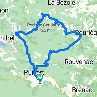
Une pente assez forte (10% environ ?) entre Lescale et le tunnel qui permet de rejoindre Montplaisir.
La route, étroite mais peu fréquentée, offre des sous-bois agréables.
- -:--
- Duration
- 25.8 km
- Distance
- 451 m
- Ascent
- 451 m
- Descent
- ---
- Avg. speed
- ---
- Avg. speed

Route highlights
Points of interest along the route
Point of interest after 0.5 km
carrefour de l'aéroport
Point of interest after 3.8 km
village de Lescale
Point of interest after 12.9 km
ferme de Montplaisir
Point of interest after 19.2 km
passage sous le tunnel
Point of interest after 23.9 km
carrefour avec la route venant de Puivert
Continue with Bikemap
Use, edit, or download this cycling route
You would like to ride Le col du Chandelier par LESCALE or customize it for your own trip? Here is what you can do with this Bikemap route:
Free features
- Save this route as favorite or in collections
- Copy & plan your own version of this route
- Sync your route with Garmin or Wahoo
Premium features
Free trial for 3 days, or one-time payment. More about Bikemap Premium.
- Navigate this route on iOS & Android
- Export a GPX / KML file of this route
- Create your custom printout (try it for free)
- Download this route for offline navigation
Discover more Premium features.
Get Bikemap PremiumFrom our community
Other popular routes starting in Chalabre
 Saint Benoit Loop
- Distance
- 46.1 km
- Ascent
- 832 m
- Descent
- 832 m
- Location
- Chalabre, Languedoc-Roussillon-Midi-Pyrénées, France
 Puivert-Espezel-Belvis 45km
- Distance
- 45 km
- Ascent
- 719 m
- Descent
- 714 m
- Location
- Chalabre, Languedoc-Roussillon-Midi-Pyrénées, France
 Chateau-Campsylvestre Loop
- Distance
- 19.9 km
- Ascent
- 411 m
- Descent
- 411 m
- Location
- Chalabre, Languedoc-Roussillon-Midi-Pyrénées, France
 TDP - ETAPE 11
- Distance
- 68.3 km
- Ascent
- 1,865 m
- Descent
- 1,168 m
- Location
- Chalabre, Languedoc-Roussillon-Midi-Pyrénées, France
 Puivert - Rennes les Bains
- Distance
- 30 km
- Ascent
- 225 m
- Descent
- 404 m
- Location
- Chalabre, Languedoc-Roussillon-Midi-Pyrénées, France
 Razes loop (St Couat du Razes & Bouriege)
- Distance
- 51.1 km
- Ascent
- 1,250 m
- Descent
- 1,269 m
- Location
- Chalabre, Languedoc-Roussillon-Midi-Pyrénées, France
 Bouriege Loop
- Distance
- 45.6 km
- Ascent
- 625 m
- Descent
- 626 m
- Location
- Chalabre, Languedoc-Roussillon-Midi-Pyrénées, France
 CC Etapa 04 PUIVERT a SANT-PAUL-DE-FENOUILLET
- Distance
- 59.3 km
- Ascent
- 570 m
- Descent
- 785 m
- Location
- Chalabre, Languedoc-Roussillon-Midi-Pyrénées, France
Open it in the app