

Sarajevo-Mostar-Cavtat
A cycling route starting in Sarajevo, Federation of Bosnia and Herzegovina, Bosnia and Herzegovina.
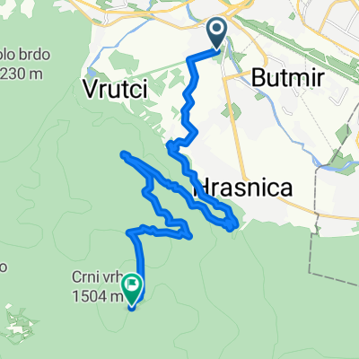
Overview
About this route
Metković-6228-Trsteno: 265km, 4740m
Metković-6220-Slano: 266km, 4480m
Metković-6228-Neum: 269km, 4460m
Metković-D8-Cavtat: 275km, 4400m
- -:--
- Duration
- 274.7 km
- Distance
- 1,263 m
- Ascent
- 1,758 m
- Descent
- ---
- Avg. speed
- ---
- Avg. speed

Route quality
Waytypes & surfaces along the route
Waytypes
Busy road
200.4 km
(73 %)
Quiet road
49.9 km
(18 %)
Surfaces
Paved
225.6 km
(82 %)
Unpaved
2.2 km
(<1 %)
Asphalt
225.6 km
(82 %)
Ground
1.1 km
(<1 %)
Continue with Bikemap
Use, edit, or download this cycling route
You would like to ride Sarajevo-Mostar-Cavtat or customize it for your own trip? Here is what you can do with this Bikemap route:
Free features
- Save this route as favorite or in collections
- Copy & plan your own version of this route
- Sync your route with Garmin or Wahoo
Premium features
Free trial for 3 days, or one-time payment. More about Bikemap Premium.
- Navigate this route on iOS & Android
- Export a GPX / KML file of this route
- Create your custom printout (try it for free)
- Download this route for offline navigation
Discover more Premium features.
Get Bikemap PremiumFrom our community
Other popular routes starting in Sarajevo
 first alternative Sarajevo-milano
- Distance
- 1,264.6 km
- Ascent
- 2,281 m
- Descent
- 2,685 m
- Location
- Sarajevo, Federation of Bosnia and Herzegovina, Bosnia and Herzegovina
 Alpasino - Krupac - Dejcici - Trnovo - Dobrinja
- Distance
- 69.4 km
- Ascent
- 909 m
- Descent
- 919 m
- Location
- Sarajevo, Federation of Bosnia and Herzegovina, Bosnia and Herzegovina
 From Sarajevo to Visoko
- Distance
- 55.3 km
- Ascent
- 1,350 m
- Descent
- 1,441 m
- Location
- Sarajevo, Federation of Bosnia and Herzegovina, Bosnia and Herzegovina
 Lukavica_Kasindol_Klanac_Lukavica
- Distance
- 32.3 km
- Ascent
- 775 m
- Descent
- 769 m
- Location
- Sarajevo, Federation of Bosnia and Herzegovina, Bosnia and Herzegovina
 MTB City Road
- Distance
- 14.6 km
- Ascent
- 270 m
- Descent
- 272 m
- Location
- Sarajevo, Federation of Bosnia and Herzegovina, Bosnia and Herzegovina
 lukavica>tvrdimići>jasik&>brus>bistrik kula
- Distance
- 45.3 km
- Ascent
- 1,519 m
- Descent
- 1,517 m
- Location
- Sarajevo, Federation of Bosnia and Herzegovina, Bosnia and Herzegovina
 Ive Andrića 17c to Ive Andrića 19j, Sarajevo
- Distance
- 35.8 km
- Ascent
- 181 m
- Descent
- 174 m
- Location
- Sarajevo, Federation of Bosnia and Herzegovina, Bosnia and Herzegovina
 h stan
- Distance
- 16.4 km
- Ascent
- 943 m
- Descent
- 131 m
- Location
- Sarajevo, Federation of Bosnia and Herzegovina, Bosnia and Herzegovina
Open it in the app