
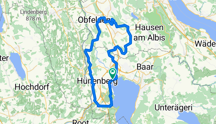
Zugersee - Säuliamt
A cycling route starting in Cham, Canton of Zug, Switzerland.
Overview
About this route
Weg vom Verkehr, fast nur Neben- und verkehrsfreie Strassen. Kurze Abschnitte gute Naturstrassen, problemlos für Rennrad.
Sehr schöne Landschaft mit vielen alten Stil-Bauernhäuser. In der Bützen, bei Wannhäusern, bewohnte Storchenhorste. Freies Naturbad 1 km nach Buonas (Langackerstrasse). Diese Tour ist auch für sportliche Kinder gut geeignet.
Parkplatz 700 m südlich vom Bahnhof Cham, (ca. km 45) beim Tennisplatz Hünenberg-Chämleten, direkt an der Route
Total: 450 Steigungsmeter
- -:--
- Duration
- 46 km
- Distance
- 523 m
- Ascent
- 519 m
- Descent
- ---
- Avg. speed
- 652 m
- Avg. speed
Route quality
Waytypes & surfaces along the route
Waytypes
Quiet road
25.5 km
(56 %)
Track
8.7 km
(19 %)
Surfaces
Paved
30 km
(65 %)
Unpaved
2.6 km
(6 %)
Asphalt
25.1 km
(55 %)
Paved (undefined)
4.9 km
(11 %)
Continue with Bikemap
Use, edit, or download this cycling route
You would like to ride Zugersee - Säuliamt or customize it for your own trip? Here is what you can do with this Bikemap route:
Free features
- Save this route as favorite or in collections
- Copy & plan your own version of this route
- Sync your route with Garmin or Wahoo
Premium features
Free trial for 3 days, or one-time payment. More about Bikemap Premium.
- Navigate this route on iOS & Android
- Export a GPX / KML file of this route
- Create your custom printout (try it for free)
- Download this route for offline navigation
Discover more Premium features.
Get Bikemap PremiumFrom our community
Other popular routes starting in Cham
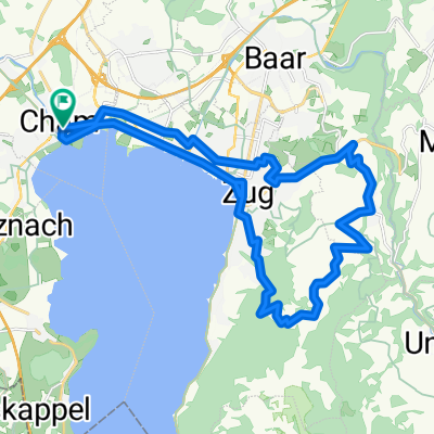
 Cham-Rotkreuz-Reuss-Cham
- Distance
- 26.1 km
- Ascent
- 122 m
- Descent
- 122 m
- Location
- Cham, Canton of Zug, Switzerland
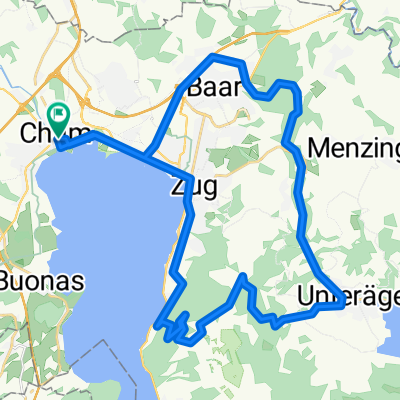
 Mugerenstrasse, Cham to City, Zürich
- Distance
- 37.2 km
- Ascent
- 557 m
- Descent
- 571 m
- Location
- Cham, Canton of Zug, Switzerland
 MORGARTEN MEMORIAL 2017
- Distance
- 43.5 km
- Ascent
- 571 m
- Descent
- 571 m
- Location
- Cham, Canton of Zug, Switzerland
 Cham - Zugerberg
- Distance
- 26.1 km
- Ascent
- 546 m
- Descent
- 546 m
- Location
- Cham, Canton of Zug, Switzerland
 Cham - Wildspitz - Ägerisee - Cham
- Distance
- 73.2 km
- Ascent
- 1,137 m
- Descent
- 1,137 m
- Location
- Cham, Canton of Zug, Switzerland
 Cham - Ägeri - Zugerberg - Cham
- Distance
- 40.1 km
- Ascent
- 581 m
- Descent
- 581 m
- Location
- Cham, Canton of Zug, Switzerland
 Feierabenrunde
- Distance
- 21.5 km
- Ascent
- 115 m
- Descent
- 114 m
- Location
- Cham, Canton of Zug, Switzerland
 Cham-Ballwil-Sins-Cham
- Distance
- 47 km
- Ascent
- 194 m
- Descent
- 301 m
- Location
- Cham, Canton of Zug, Switzerland
Open it in the app