

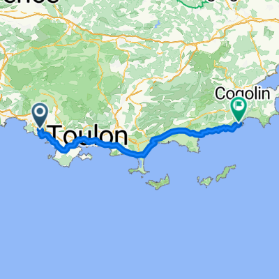
Bandol 82km
A cycling route starting in Bandol AOC, Provence-Alpes-Côte d'Azur Region, France.
Overview
About this route
Bandol , sanary , Ollioules , gare de la Seyne , piste cyclable Vauban , Toulon , le Mourillon , Cap Brun , le Pradet , Carqueiranne , le col de Serre , la Crau , la Valette , toulon nord , ollioules , Sanary , Bandol
- -:--
- Duration
- 82.4 km
- Distance
- 490 m
- Ascent
- 484 m
- Descent
- ---
- Avg. speed
- ---
- Avg. speed
Route quality
Waytypes & surfaces along the route
Waytypes
Busy road
68 km
(83 %)
Road
7.1 km
(9 %)
Surfaces
Paved
60.1 km
(73 %)
Asphalt
59.9 km
(73 %)
Paved (undefined)
0.2 km
(<1 %)
Continue with Bikemap
Use, edit, or download this cycling route
You would like to ride Bandol 82km or customize it for your own trip? Here is what you can do with this Bikemap route:
Free features
- Save this route as favorite or in collections
- Copy & plan your own version of this route
- Sync your route with Garmin or Wahoo
Premium features
Free trial for 3 days, or one-time payment. More about Bikemap Premium.
- Navigate this route on iOS & Android
- Export a GPX / KML file of this route
- Create your custom printout (try it for free)
- Download this route for offline navigation
Discover more Premium features.
Get Bikemap PremiumFrom our community
Other popular routes starting in Bandol AOC
 Bandol - Le Castellet
- Distance
- 27.8 km
- Ascent
- 434 m
- Descent
- 441 m
- Location
- Bandol AOC, Provence-Alpes-Côte d'Azur Region, France
 Gros Cerveau et Roustagnon
- Distance
- 14.8 km
- Ascent
- 595 m
- Descent
- 554 m
- Location
- Bandol AOC, Provence-Alpes-Côte d'Azur Region, France
 XPT 13N Casino Bandol
- Distance
- 3.2 km
- Ascent
- 18 m
- Descent
- 136 m
- Location
- Bandol AOC, Provence-Alpes-Côte d'Azur Region, France
 le beausset
- Distance
- 14.6 km
- Ascent
- 336 m
- Descent
- 233 m
- Location
- Bandol AOC, Provence-Alpes-Côte d'Azur Region, France
 Facile à conduire Bandol
- Distance
- 9.3 km
- Ascent
- 173 m
- Descent
- 303 m
- Location
- Bandol AOC, Provence-Alpes-Côte d'Azur Region, France
 Bandol 63km
- Distance
- 63.4 km
- Ascent
- 734 m
- Descent
- 736 m
- Location
- Bandol AOC, Provence-Alpes-Côte d'Azur Region, France
 XPT 14J Bandol - Cavalaire
- Distance
- 86.7 km
- Ascent
- 293 m
- Descent
- 399 m
- Location
- Bandol AOC, Provence-Alpes-Côte d'Azur Region, France
 Pointe du cerveau
- Distance
- 6 km
- Ascent
- 365 m
- Descent
- 106 m
- Location
- Bandol AOC, Provence-Alpes-Côte d'Azur Region, France
Open it in the app