

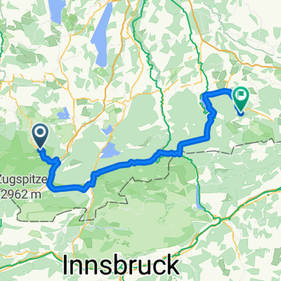
Oberammergau-Bad Kohlgrub-Murmau am Staffelsee
A cycling route starting in Oberammergau, Bavaria, Germany.
Overview
About this route
Čím více zde napíšete informací, tím více bude užitečnější pro ostatním uživatele.<br /><br />* Průběh trasy.<br />* Co je zvláštní na této trase?<br />* Proč doporučit tuto trasu?<br />* Co se Vám zde nejvíce líbilo?<br />* Atd.
- -:--
- Duration
- 24.1 km
- Distance
- 157 m
- Ascent
- 308 m
- Descent
- ---
- Avg. speed
- ---
- Avg. speed
Route quality
Waytypes & surfaces along the route
Waytypes
Busy road
16.9 km
(70 %)
Road
3.7 km
(15 %)
Surfaces
Paved
23.4 km
(97 %)
Unpaved
0.3 km
(1 %)
Asphalt
22.8 km
(95 %)
Paved (undefined)
0.5 km
(2 %)
Continue with Bikemap
Use, edit, or download this cycling route
You would like to ride Oberammergau-Bad Kohlgrub-Murmau am Staffelsee or customize it for your own trip? Here is what you can do with this Bikemap route:
Free features
- Save this route as favorite or in collections
- Copy & plan your own version of this route
- Sync your route with Garmin or Wahoo
Premium features
Free trial for 3 days, or one-time payment. More about Bikemap Premium.
- Navigate this route on iOS & Android
- Export a GPX / KML file of this route
- Create your custom printout (try it for free)
- Download this route for offline navigation
Discover more Premium features.
Get Bikemap PremiumFrom our community
Other popular routes starting in Oberammergau
 Ettaler Mandl - Drei-Marken
- Distance
- 42.8 km
- Ascent
- 1,071 m
- Descent
- 1,068 m
- Location
- Oberammergau, Bavaria, Germany
 Auf den Pürschling bei Oberammergau
- Distance
- 13 km
- Ascent
- 785 m
- Descent
- 787 m
- Location
- Oberammergau, Bavaria, Germany
 Pürschlinghaus
- Distance
- 15.9 km
- Ascent
- 714 m
- Descent
- 717 m
- Location
- Oberammergau, Bavaria, Germany
 Aufacker path
- Distance
- 10.3 km
- Ascent
- 547 m
- Descent
- 551 m
- Location
- Oberammergau, Bavaria, Germany
 Unternogg
- Distance
- 10.6 km
- Ascent
- 69 m
- Descent
- 69 m
- Location
- Oberammergau, Bavaria, Germany
 Oberammergauer Höhenrunde
- Distance
- 42 km
- Ascent
- 1,023 m
- Descent
- 1,023 m
- Location
- Oberammergau, Bavaria, Germany
 TAC 2012 Etappe 1: Oberammgergau-Imst
- Distance
- 95.3 km
- Ascent
- 1,619 m
- Descent
- 1,673 m
- Location
- Oberammergau, Bavaria, Germany
 Bayerntour 2009 Etappe 2
- Distance
- 111.2 km
- Ascent
- 1,084 m
- Descent
- 1,162 m
- Location
- Oberammergau, Bavaria, Germany
Open it in the app