

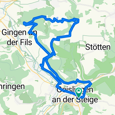
Geislingen-Neidlinger Steige
A cycling route starting in Geislingen an der Steige, Baden-Württemberg, Germany.
Overview
About this route
durchgehend Asphalt
Steigen sehr gut befahrbar
bergig
teilweise Verkehr
Temperaturunterschiede im April deutlich
- -:--
- Duration
- 65.4 km
- Distance
- 568 m
- Ascent
- 568 m
- Descent
- ---
- Avg. speed
- ---
- Avg. speed

Route quality
Waytypes & surfaces along the route
Waytypes
Busy road
20.1 km
(31 %)
Quiet road
19.1 km
(29 %)
Surfaces
Paved
53.3 km
(81 %)
Unpaved
0.6 km
(<1 %)
Asphalt
48.2 km
(74 %)
Paved (undefined)
4.7 km
(7 %)
Continue with Bikemap
Use, edit, or download this cycling route
You would like to ride Geislingen-Neidlinger Steige or customize it for your own trip? Here is what you can do with this Bikemap route:
Free features
- Save this route as favorite or in collections
- Copy & plan your own version of this route
- Sync your route with Garmin or Wahoo
Premium features
Free trial for 3 days, or one-time payment. More about Bikemap Premium.
- Navigate this route on iOS & Android
- Export a GPX / KML file of this route
- Create your custom printout (try it for free)
- Download this route for offline navigation
Discover more Premium features.
Get Bikemap PremiumFrom our community
Other popular routes starting in Geislingen an der Steige
 Geislingen-Eselhöfe-Oppingen
- Distance
- 56 km
- Ascent
- 699 m
- Descent
- 680 m
- Location
- Geislingen an der Steige, Baden-Württemberg, Germany
 Albtäler Radweg
- Distance
- 186.2 km
- Ascent
- 902 m
- Descent
- 902 m
- Location
- Geislingen an der Steige, Baden-Württemberg, Germany
 Geislingen - Fuckseck
- Distance
- 37.5 km
- Ascent
- 628 m
- Descent
- 609 m
- Location
- Geislingen an der Steige, Baden-Württemberg, Germany
 Geislingen-Kuchalb-Weißenstein-Runde
- Distance
- 42.1 km
- Ascent
- 1,437 m
- Descent
- 1,411 m
- Location
- Geislingen an der Steige, Baden-Württemberg, Germany
 Geislingen - Kaltes Feld - Grünenberg
- Distance
- 61.9 km
- Ascent
- 859 m
- Descent
- 859 m
- Location
- Geislingen an der Steige, Baden-Württemberg, Germany
 Albtaeler Radweg
- Distance
- 186.1 km
- Ascent
- 894 m
- Descent
- 894 m
- Location
- Geislingen an der Steige, Baden-Württemberg, Germany
 Marrenwald-Oberweckerstell
- Distance
- 26.9 km
- Ascent
- 547 m
- Descent
- 545 m
- Location
- Geislingen an der Steige, Baden-Württemberg, Germany
 Geislingen - Ulm
- Distance
- 107.8 km
- Ascent
- 1,050 m
- Descent
- 820 m
- Location
- Geislingen an der Steige, Baden-Württemberg, Germany
Open it in the app