
Schönert & blauer M-Weg
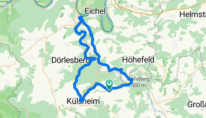
A cycling route starting in Külsheim, Baden-Württemberg, Germany.
Overview
About this route
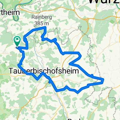
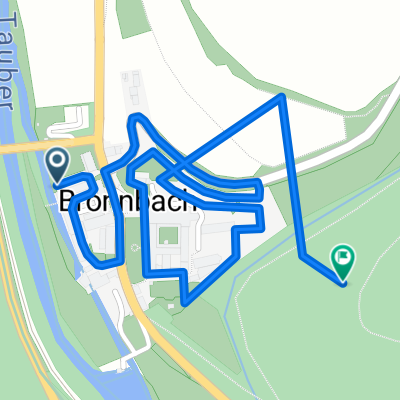
Route startet in Uissigheim am Sportplatz und verläuft bis Bronnbach hauptsächlich auf Forstwegen. Ab Bronnbach auf dem Taubertalradweg nach Wertheim. In Wertheim, ab der Burg, den Markierungen mit dem "blauen M" folgen (ob die Koordinaten alle stimmen kann ich ab Wertheim nicht mehr garantieren.
In Gamburg Richtung "Uissigheim" fahren, Nach der Mühle wieder nach rechts auf den Radweg Richtung Wertheim, nach ca. 100m nach links wieder den Berg hoch.
Wenn man wieder "auf der Höhe" ist, kann man bis nach Wertheim schauen.
- -:--
- Duration
- 35.2 km
- Distance
- 552 m
- Ascent
- 555 m
- Descent
- ---
- Avg. speed
- ---
- Avg. speed
Continue with Bikemap
Use, edit, or download this cycling route
You would like to ride Schönert & blauer M-Weg or customize it for your own trip? Here is what you can do with this Bikemap route:
Free features
- Save this route as favorite or in collections
- Copy & plan your own version of this route
- Sync your route with Garmin or Wahoo
Premium features
Free trial for 3 days, or one-time payment. More about Bikemap Premium.
- Navigate this route on iOS & Android
- Export a GPX / KML file of this route
- Create your custom printout (try it for free)
- Download this route for offline navigation
Discover more Premium features.
Get Bikemap PremiumFrom our community
Other popular routes starting in Külsheim
 Schönert & blauer M-Weg
- Distance
- 35.2 km
- Ascent
- 552 m
- Descent
- 555 m
- Location
- Külsheim, Baden-Württemberg, Germany
 Tauber-Main_04
- Distance
- 52.6 km
- Ascent
- 352 m
- Descent
- 352 m
- Location
- Külsheim, Baden-Württemberg, Germany
 Route nach Külsheim
- Distance
- 51.3 km
- Ascent
- 1,016 m
- Descent
- 997 m
- Location
- Külsheim, Baden-Württemberg, Germany
 Hügeltour
- Distance
- 86.9 km
- Ascent
- 1,337 m
- Descent
- 1,385 m
- Location
- Külsheim, Baden-Württemberg, Germany
 LT 3 Wein und Glaube Bronnbach nach Wertheim
- Distance
- 9.1 km
- Ascent
- 542 m
- Descent
- 542 m
- Location
- Külsheim, Baden-Württemberg, Germany
 Külsheim-Hardheim-Heckfeld-Külsheim
- Distance
- 50 km
- Ascent
- 620 m
- Descent
- 613 m
- Location
- Külsheim, Baden-Württemberg, Germany
 Begehung Kloster Bronnbach
- Distance
- 2.2 km
- Ascent
- 112 m
- Descent
- 42 m
- Location
- Külsheim, Baden-Württemberg, Germany
 www.12Stundenrennen.de
- Distance
- 12.2 km
- Ascent
- 242 m
- Descent
- 240 m
- Location
- Külsheim, Baden-Württemberg, Germany
Open it in the app