Premium Badge Download on the App Store Get it on Google Play Turn-by-turn Navigation Offline Maps Bike Type Optimized Routing Premium Maps Custom Bike Computer Export Routes Route Previews Fall Detection Premium Support

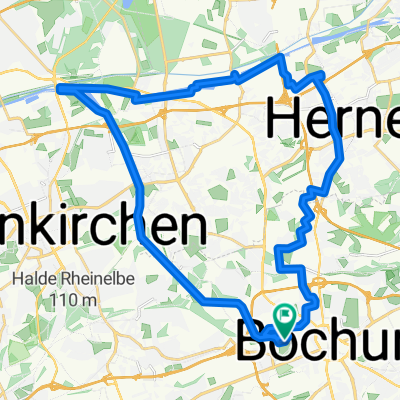
Cycling Route in Bochum, North Rhine-Westphalia, Germany

Präsidium Bochum - Essen Margarethenhöhe - Erzbahntrasse

2
Open this route in the Bikemap app

Open this route in the Bikemap app

Open this route in Bikemap Web

Open this route in Bikemap Web

68 km
Distance
265 m
Ascent
265 m
Descent
-:-- h
Duration
-- km/h
Avg. Speed
--- m
Max. Elevation

About This Route

Die Route beginnt am Polizeipräsidium Bochum und führt zunächst über die Königsallee nach Hattingen zum Ruhrtalradweg. Von dort geht es über den RTR bis zur ersten Raststelle in Essen, Westfalenstr. in der Bar Celona. Von dort führt die Route weiter über die sogenannte Wasserroute - einer ehemaligen Bahntrasse - entlang des Essener Stadtwaldes zum ersten Ziel, der Margarethenhöhe. Je nach Bedarf kann man hier die einzigartige Siedlungsbauweise besichtigen. Die Strecke führt von dort aus wieder zurück zur Wasserroute mit dem Ziel: Zeche Zollverein. Nach einer kurzen Rast geht es entlang des Emscher Parkradweges über die Erzbahntrasse zurück in Richtung Bochum Jahrhunderthalle. Durch die Innenstadt Bochums gelangen wir zum Ausgangspunkt zurück.

(cloned from route 1434675)

This cycling route is ideal for: MTB

You will cycle on the following surfaces: Unpaved

Customize this cycling route with the Bikemap route planner.

Make it yours!

Did you know? You can use this route as a template in our cycling route planner if you don't wish to start from scratch. Customize it based on your needs to plan your perfect cycling tour.

Open it in the app