

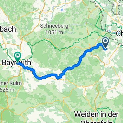
4Tag Tour Bad Schandau
A cycling route starting in Waldsassen, Bavaria, Germany.
Overview
About this route
4.Etappe
(cloned from route 2148241)
- -:--
- Duration
- 108.1 km
- Distance
- 1,078 m
- Ascent
- 834 m
- Descent
- ---
- Avg. speed
- ---
- Avg. speed
Route quality
Waytypes & surfaces along the route
Waytypes
Road
56.3 km
(52 %)
Busy road
45.1 km
(42 %)
Surfaces
Paved
56.7 km
(52 %)
Unpaved
0.1 km
(<1 %)
Asphalt
56.7 km
(52 %)
Unpaved (undefined)
0.1 km
(<1 %)
Continue with Bikemap
Use, edit, or download this cycling route
You would like to ride 4Tag Tour Bad Schandau or customize it for your own trip? Here is what you can do with this Bikemap route:
Free features
- Save this route as favorite or in collections
- Copy & plan your own version of this route
- Sync your route with Garmin or Wahoo
Premium features
Free trial for 3 days, or one-time payment. More about Bikemap Premium.
- Navigate this route on iOS & Android
- Export a GPX / KML file of this route
- Create your custom printout (try it for free)
- Download this route for offline navigation
Discover more Premium features.
Get Bikemap PremiumFrom our community
Other popular routes starting in Waldsassen
 10.07.17 Konnersreuth-Adorf (6. Etappe)
- Distance
- 56.2 km
- Ascent
- 421 m
- Descent
- 543 m
- Location
- Waldsassen, Bavaria, Germany
 Wald - Tirsch
- Distance
- 17.5 km
- Ascent
- 146 m
- Descent
- 135 m
- Location
- Waldsassen, Bavaria, Germany
 KonersreutBürgerreut
- Distance
- 71.4 km
- Ascent
- 343 m
- Descent
- 590 m
- Location
- Waldsassen, Bavaria, Germany
 2. Teil Furth i.Wald - Cossebaude
- Distance
- 133.9 km
- Ascent
- 1,768 m
- Descent
- 1,699 m
- Location
- Waldsassen, Bavaria, Germany
 Wallensteinradweg - Mühlenradweg
- Distance
- 62.1 km
- Ascent
- 636 m
- Descent
- 623 m
- Location
- Waldsassen, Bavaria, Germany
 4. Tag Waldsassen-Königsfeld
- Distance
- 108.8 km
- Ascent
- 800 m
- Descent
- 829 m
- Location
- Waldsassen, Bavaria, Germany
 Egergrabenradweg EGW
- Distance
- 79.2 km
- Ascent
- ---
- Descent
- ---
- Location
- Waldsassen, Bavaria, Germany
 Rund um Mitterteich
- Distance
- 34 km
- Ascent
- 375 m
- Descent
- 381 m
- Location
- Waldsassen, Bavaria, Germany
Open it in the app