

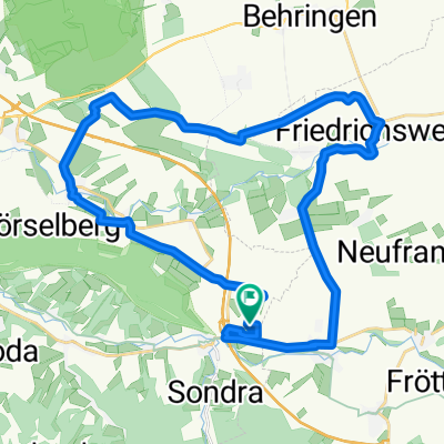
Alte Heimat Teutleben-Gr.Inselsberg (916m)
A cycling route starting in Mechterstädt, Free State of Thuringia, Germany.
Overview
About this route
Eine Tour die ich vor Vielen Jahren mal gefahren bin. Sehr hart (für mich) aber mit toller Aussicht und rasanter Abfahrt.
- -:--
- Duration
- 48.8 km
- Distance
- 881 m
- Ascent
- 865 m
- Descent
- ---
- Avg. speed
- 913 m
- Avg. speed

Route quality
Waytypes & surfaces along the route
Waytypes
Busy road
23.6 km
(48 %)
Road
12.6 km
(26 %)
Surfaces
Paved
31.4 km
(64 %)
Unpaved
2.7 km
(6 %)
Asphalt
29.6 km
(61 %)
Ground
1.9 km
(4 %)
Continue with Bikemap
Use, edit, or download this cycling route
You would like to ride Alte Heimat Teutleben-Gr.Inselsberg (916m) or customize it for your own trip? Here is what you can do with this Bikemap route:
Free features
- Save this route as favorite or in collections
- Copy & plan your own version of this route
- Sync your route with Garmin or Wahoo
Premium features
Free trial for 3 days, or one-time payment. More about Bikemap Premium.
- Navigate this route on iOS & Android
- Export a GPX / KML file of this route
- Create your custom printout (try it for free)
- Download this route for offline navigation
Discover more Premium features.
Get Bikemap PremiumFrom our community
Other popular routes starting in Mechterstädt
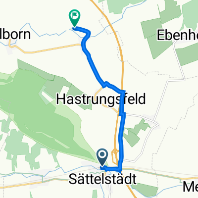
 TH-Hörselberge-Sättelstädt-Wutha
- Distance
- 9.1 km
- Ascent
- 313 m
- Descent
- 338 m
- Location
- Mechterstädt, Free State of Thuringia, Germany
 ¿œ∆⁄? nach ¿œ∆⁄?
- Distance
- 23.5 km
- Ascent
- 428 m
- Descent
- 396 m
- Location
- Mechterstädt, Free State of Thuringia, Germany
 Am Noßbach 1, Hörselberg-Hainich nach Am Noßbach 1, Hörselberg-Hainich
- Distance
- 31.7 km
- Ascent
- 724 m
- Descent
- 726 m
- Location
- Mechterstädt, Free State of Thuringia, Germany
 Am Noßbach 1, Hörselberg-Hainich nach Am Noßbach 1, Hörselberg-Hainich
- Distance
- 32.3 km
- Ascent
- 343 m
- Descent
- 343 m
- Location
- Mechterstädt, Free State of Thuringia, Germany
 Am Fridolinsdamm 6, Hörsel nach Karolinenstraße, Eisenach
- Distance
- 22 km
- Ascent
- 188 m
- Descent
- 267 m
- Location
- Mechterstädt, Free State of Thuringia, Germany
 Sättelstädt - Klappmühle
- Distance
- 4.9 km
- Ascent
- 30 m
- Descent
- 53 m
- Location
- Mechterstädt, Free State of Thuringia, Germany
 Am Noßbach 1, Hörselberg-Hainich nach Am Noßbach 1, Hörselberg-Hainich
- Distance
- 31.8 km
- Ascent
- 349 m
- Descent
- 349 m
- Location
- Mechterstädt, Free State of Thuringia, Germany
 Insel 54, Hörselberg-Hainich nach Insel 54, Hörselberg-Hainich
- Distance
- 14 km
- Ascent
- 183 m
- Descent
- 184 m
- Location
- Mechterstädt, Free State of Thuringia, Germany
Open it in the app