

Erdély első nap
A cycling route starting in Sândominic, Harghita County, Romania.
Overview
About this route
Route to Terkő (map not completely accurate) to Borospatakáig via Tehenész. Tough start, MTB school tour on wet road. Caution with dogs ;-)
- -:--
- Duration
- 39.2 km
- Distance
- 765 m
- Ascent
- 539 m
- Descent
- ---
- Avg. speed
- ---
- Max. altitude

Route quality
Waytypes & surfaces along the route
Waytypes
Quiet road
16.8 km
(43 %)
Undefined
22.3 km
(57 %)
Surfaces
Paved
20.8 km
(53 %)
Unpaved
15.7 km
(40 %)
Asphalt
14.1 km
(36 %)
Gravel
7.1 km
(18 %)
Continue with Bikemap
Use, edit, or download this cycling route
You would like to ride Erdély első nap or customize it for your own trip? Here is what you can do with this Bikemap route:
Free features
- Save this route as favorite or in collections
- Copy & plan your own version of this route
- Sync your route with Garmin or Wahoo
Premium features
Free trial for 3 days, or one-time payment. More about Bikemap Premium.
- Navigate this route on iOS & Android
- Export a GPX / KML file of this route
- Create your custom printout (try it for free)
- Download this route for offline navigation
Discover more Premium features.
Get Bikemap PremiumFrom our community
Other popular routes starting in Sândominic
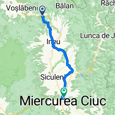 From Voșlăbeni to Miercurea Ciuc
- Distance
- 40 km
- Ascent
- 540 m
- Descent
- 744 m
- Location
- Sândominic, Harghita County, Romania
 Cros Mures-Olt Marathon
- Distance
- 13.9 km
- Ascent
- 701 m
- Descent
- 700 m
- Location
- Sândominic, Harghita County, Romania
 2019 Cross Mures Olt Marathon
- Distance
- 13.5 km
- Ascent
- 645 m
- Descent
- 649 m
- Location
- Sândominic, Harghita County, Romania
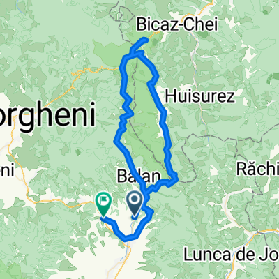 Balan- Lacul Rosu- Cheile Bicazului- Trei Fantani-Balan
- Distance
- 78.6 km
- Ascent
- 1,878 m
- Descent
- 1,874 m
- Location
- Sândominic, Harghita County, Romania
 2019 Maraton Mures Olt Marathon
- Distance
- 42.9 km
- Ascent
- 2,565 m
- Descent
- 2,567 m
- Location
- Sândominic, Harghita County, Romania
 Marosfo - Gyergyo - Toplica - Deda - Regen - Mvh
- Distance
- 158.6 km
- Ascent
- 115 m
- Descent
- 667 m
- Location
- Sândominic, Harghita County, Romania
 Marosfő - Libán tető
- Distance
- 21.1 km
- Ascent
- 671 m
- Descent
- 567 m
- Location
- Sândominic, Harghita County, Romania
 Maris bike trail Jul2020
- Distance
- 639.4 km
- Ascent
- 126 m
- Descent
- 920 m
- Location
- Sândominic, Harghita County, Romania
Open it in the app