

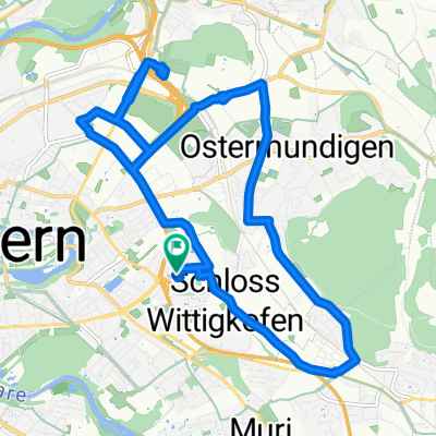
Tour Mänziwilegg - Moosegg
A cycling route starting in Ostermundigen, Canton of Bern, Switzerland.
Overview
About this route
Ostring - Boll - Utzigen - Mänziwilegg - Schafhausen - Langnau - Moosegg - Biglen - Worb - Ittigen
- -:--
- Duration
- 61.2 km
- Distance
- 808 m
- Ascent
- 818 m
- Descent
- ---
- Avg. speed
- ---
- Avg. speed
Route quality
Waytypes & surfaces along the route
Waytypes
Quiet road
23.8 km
(39 %)
Busy road
22.8 km
(37 %)
Surfaces
Paved
29.1 km
(47 %)
Unpaved
0.1 km
(<1 %)
Asphalt
29.1 km
(47 %)
Gravel
0.1 km
(<1 %)
Undefined
32 km
(52 %)
Continue with Bikemap
Use, edit, or download this cycling route
You would like to ride Tour Mänziwilegg - Moosegg or customize it for your own trip? Here is what you can do with this Bikemap route:
Free features
- Save this route as favorite or in collections
- Copy & plan your own version of this route
- Sync your route with Garmin or Wahoo
Premium features
Free trial for 3 days, or one-time payment. More about Bikemap Premium.
- Navigate this route on iOS & Android
- Export a GPX / KML file of this route
- Create your custom printout (try it for free)
- Download this route for offline navigation
Discover more Premium features.
Get Bikemap PremiumFrom our community
Other popular routes starting in Ostermundigen
 Late afternoon
- Distance
- 15.2 km
- Ascent
- 61 m
- Descent
- 60 m
- Location
- Ostermundigen, Canton of Bern, Switzerland
 Recovered Route
- Distance
- 37.9 km
- Ascent
- 915 m
- Descent
- 910 m
- Location
- Ostermundigen, Canton of Bern, Switzerland
 Velotour 2020_1
- Distance
- 305.3 km
- Ascent
- 700 m
- Descent
- 684 m
- Location
- Ostermundigen, Canton of Bern, Switzerland
 Tour de France 2016 - Stage 17
- Distance
- 198.6 km
- Ascent
- 3,216 m
- Descent
- 1,807 m
- Location
- Ostermundigen, Canton of Bern, Switzerland
 Bern-Wichtrach-Bern
- Distance
- 41.6 km
- Ascent
- 591 m
- Descent
- 585 m
- Location
- Ostermundigen, Canton of Bern, Switzerland
 ch12 Ostermundigen - Zollikofen - Meikirch - Zollikofen - Ostermundigen
- Distance
- 33.1 km
- Ascent
- 344 m
- Descent
- 343 m
- Location
- Ostermundigen, Canton of Bern, Switzerland
 drive around
- Distance
- 16.1 km
- Ascent
- 159 m
- Descent
- 155 m
- Location
- Ostermundigen, Canton of Bern, Switzerland
 Aaretal - Gürbetal PS
- Distance
- 56.7 km
- Ascent
- 148 m
- Descent
- 196 m
- Location
- Ostermundigen, Canton of Bern, Switzerland
Open it in the app