

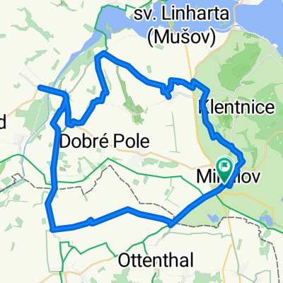
Mikulov - Laa - Hrušovany - Mikulov
A cycling route starting in Mikulov, South Moravian, Czechia.
Overview
About this route
Pohraniční vesnice
- -:--
- Duration
- 59.2 km
- Distance
- 239 m
- Ascent
- 245 m
- Descent
- ---
- Avg. speed
- ---
- Avg. speed

Route quality
Waytypes & surfaces along the route
Waytypes
Busy road
25.7 km
(43 %)
Road
12.7 km
(21 %)
Surfaces
Paved
46.4 km
(78 %)
Unpaved
0.9 km
(2 %)
Asphalt
44.5 km
(75 %)
Paved (undefined)
0.8 km
(1 %)
Continue with Bikemap
Use, edit, or download this cycling route
You would like to ride Mikulov - Laa - Hrušovany - Mikulov or customize it for your own trip? Here is what you can do with this Bikemap route:
Free features
- Save this route as favorite or in collections
- Copy & plan your own version of this route
- Sync your route with Garmin or Wahoo
Premium features
Free trial for 3 days, or one-time payment. More about Bikemap Premium.
- Navigate this route on iOS & Android
- Export a GPX / KML file of this route
- Create your custom printout (try it for free)
- Download this route for offline navigation
Discover more Premium features.
Get Bikemap PremiumFrom our community
Other popular routes starting in Mikulov
 Mikulov Radrundweg
- Distance
- 86.6 km
- Ascent
- 353 m
- Descent
- 381 m
- Location
- Mikulov, South Moravian, Czechia
 den 2 - Mikulov, Bavory, Dolni Dunajovice, Novosedly, Austria
- Distance
- 50.1 km
- Ascent
- 275 m
- Descent
- 284 m
- Location
- Mikulov, South Moravian, Czechia
 Vinné tour 2006 1.den
- Distance
- 62.9 km
- Ascent
- 366 m
- Descent
- 366 m
- Location
- Mikulov, South Moravian, Czechia
 Route to Sedlec
- Distance
- 40.5 km
- Ascent
- 319 m
- Descent
- 319 m
- Location
- Mikulov, South Moravian, Czechia
 Kolem hradů Staatz a Falkenstein
- Distance
- 51 km
- Ascent
- 448 m
- Descent
- 451 m
- Location
- Mikulov, South Moravian, Czechia
 Palavsky Krpal
- Distance
- 36.4 km
- Ascent
- 411 m
- Descent
- 394 m
- Location
- Mikulov, South Moravian, Czechia
 Mikulov - Laa - Mikulov
- Distance
- 59.6 km
- Ascent
- 167 m
- Descent
- 127 m
- Location
- Mikulov, South Moravian, Czechia
 Náměstí 24/27, Mikulov do Náměstí 24/27, Mikulov
- Distance
- 25.3 km
- Ascent
- 374 m
- Descent
- 373 m
- Location
- Mikulov, South Moravian, Czechia
Open it in the app