

Bornwald
A cycling route starting in Börnichen, Saxony, Germany.
Overview
About this route
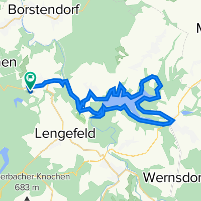
Fahrt durch den Bornwald
- -:--
- Duration
- 22 km
- Distance
- 354 m
- Ascent
- 344 m
- Descent
- ---
- Avg. speed
- ---
- Avg. speed
Route quality
Waytypes & surfaces along the route
Waytypes
Track
18.5 km
(84 %)
Busy road
2.3 km
(10 %)
Surfaces
Paved
14.8 km
(67 %)
Unpaved
7.2 km
(33 %)
Asphalt
8 km
(36 %)
Paved (undefined)
6.8 km
(31 %)
Continue with Bikemap
Use, edit, or download this cycling route
You would like to ride Bornwald or customize it for your own trip? Here is what you can do with this Bikemap route:
Free features
- Save this route as favorite or in collections
- Copy & plan your own version of this route
- Sync your route with Garmin or Wahoo
Premium features
Free trial for 3 days, or one-time payment. More about Bikemap Premium.
- Navigate this route on iOS & Android
- Export a GPX / KML file of this route
- Create your custom printout (try it for free)
- Download this route for offline navigation
Discover more Premium features.
Get Bikemap PremiumFrom our community
Other popular routes starting in Börnichen
 Bornwald
- Distance
- 22 km
- Ascent
- 340 m
- Descent
- 329 m
- Location
- Börnichen, Saxony, Germany
 Bahnhof Wilischthal Thumernetz 2022-08-14
- Distance
- 27.9 km
- Ascent
- 767 m
- Descent
- 767 m
- Location
- Börnichen, Saxony, Germany
 Waldkirchener Straße 38, Zschopau nach Goldbachweg, Pockau-Lengefeld
- Distance
- 29.5 km
- Ascent
- 686 m
- Descent
- 531 m
- Location
- Börnichen, Saxony, Germany
 Easy ride in Marienberg
- Distance
- 10.8 km
- Ascent
- 227 m
- Descent
- 99 m
- Location
- Börnichen, Saxony, Germany
 Garten-Heim-Alternativ
- Distance
- 22.7 km
- Ascent
- 513 m
- Descent
- 618 m
- Location
- Börnichen, Saxony, Germany
 Auf nach Siebenbürgen
- Distance
- 1,241.9 km
- Ascent
- 1,430 m
- Descent
- 1,505 m
- Location
- Börnichen, Saxony, Germany
 Trip 2022-08-11
- Distance
- 51.8 km
- Ascent
- 1,205 m
- Descent
- 1,205 m
- Location
- Börnichen, Saxony, Germany
 Saidenbachtalsperre 2022-04-12
- Distance
- 25.2 km
- Ascent
- 510 m
- Descent
- 510 m
- Location
- Börnichen, Saxony, Germany
Open it in the app