

Emmentaler-Radweg
A cycling route starting in Rückholz, Bavaria, Germany.
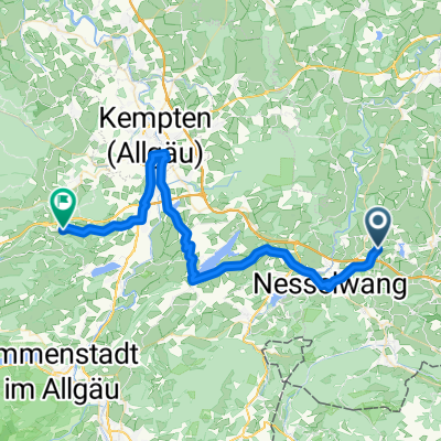
Overview
About this route
Diese Runde entpricht der Beschilderung des Milchwirtschaftlichen Vereins Allgäu mit dem Symbol Emmentaler Laib
- -:--
- Duration
- 37.7 km
- Distance
- 292 m
- Ascent
- 292 m
- Descent
- ---
- Avg. speed
- ---
- Avg. speed

Route quality
Waytypes & surfaces along the route
Waytypes
Quiet road
23.5 km
(62 %)
Path
6.1 km
(16 %)
Surfaces
Paved
27.1 km
(72 %)
Unpaved
6 km
(16 %)
Asphalt
25.9 km
(69 %)
Gravel
5.4 km
(14 %)
Continue with Bikemap
Use, edit, or download this cycling route
You would like to ride Emmentaler-Radweg or customize it for your own trip? Here is what you can do with this Bikemap route:
Free features
- Save this route as favorite or in collections
- Copy & plan your own version of this route
- Sync your route with Garmin or Wahoo
Premium features
Free trial for 3 days, or one-time payment. More about Bikemap Premium.
- Navigate this route on iOS & Android
- Export a GPX / KML file of this route
- Create your custom printout (try it for free)
- Download this route for offline navigation
Discover more Premium features.
Get Bikemap PremiumFrom our community
Other popular routes starting in Rückholz
 zuizu
zuizu- Distance
- 44.9 km
- Ascent
- 486 m
- Descent
- 571 m
- Location
- Rückholz, Bavaria, Germany
 8 seen
- Distance
- 25.7 km
- Ascent
- 211 m
- Descent
- 213 m
- Location
- Rückholz, Bavaria, Germany
 Seeg Käseroute
- Distance
- 33.6 km
- Ascent
- 245 m
- Descent
- 245 m
- Location
- Rückholz, Bavaria, Germany
 Rückholz-Käseroute 34 km
- Distance
- 33.5 km
- Ascent
- 254 m
- Descent
- 254 m
- Location
- Rückholz, Bavaria, Germany
 34_Rückholz Käseroute
- Distance
- 33.5 km
- Ascent
- 254 m
- Descent
- 254 m
- Location
- Rückholz, Bavaria, Germany
 Wertach-Grünten
- Distance
- 10.5 km
- Ascent
- 154 m
- Descent
- 94 m
- Location
- Rückholz, Bavaria, Germany
 Seeg-Rückholz
- Distance
- 7.3 km
- Ascent
- 61 m
- Descent
- 80 m
- Location
- Rückholz, Bavaria, Germany
 Rückholz-Nesselwang-Runde
- Distance
- 26.8 km
- Ascent
- 265 m
- Descent
- 265 m
- Location
- Rückholz, Bavaria, Germany
Open it in the app