
Rundtour "Fränkischer Mühlenradweg - südl. Teil"
A cycling route starting in Sachsen, Bavaria, Germany.
Overview
About this route
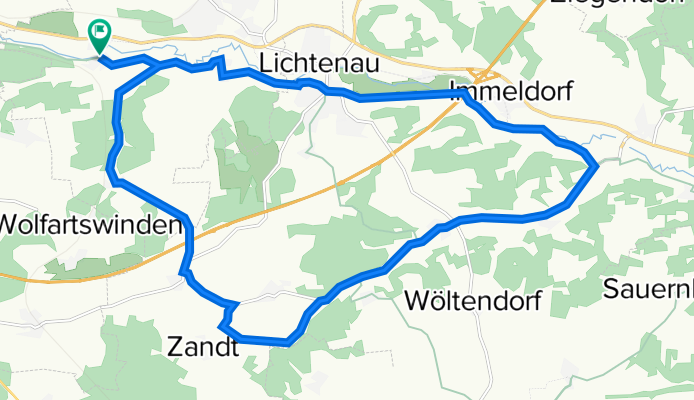
Fränkischer Mühlenradweg bei Ansbach mit Höhenmetern.
Der südl. Teil des Radwegs ist kürzer und ohne größere Steigungen! Die genaue Beschreibung ist hier zu finden: --> www.romantisches-franken.de/download.php?file=muehlenradweg-karte.pdf- -:--
- Duration
- 23.2 km
- Distance
- 99 m
- Ascent
- 101 m
- Descent
- ---
- Avg. speed
- ---
- Avg. speed

Route quality
Waytypes & surfaces along the route
Waytypes
Quiet road
11.2 km
(48 %)
Track
6.3 km
(27 %)
Surfaces
Paved
11.9 km
(51 %)
Unpaved
0.1 km
(<1 %)
Paved (undefined)
4.6 km
(20 %)
Paving stones
2.7 km
(12 %)
Continue with Bikemap
Use, edit, or download this cycling route
You would like to ride Rundtour "Fränkischer Mühlenradweg - südl. Teil" or customize it for your own trip? Here is what you can do with this Bikemap route:
Free features
- Save this route as favorite or in collections
- Copy & plan your own version of this route
- Sync your route with Garmin or Wahoo
Premium features
Free trial for 3 days, or one-time payment. More about Bikemap Premium.
- Navigate this route on iOS & Android
- Export a GPX / KML file of this route
- Create your custom printout (try it for free)
- Download this route for offline navigation
Discover more Premium features.
Get Bikemap PremiumFrom our community
Other popular routes starting in Sachsen
 Fränkischer Mühlenweg
- Distance
- 25.6 km
- Ascent
- 179 m
- Descent
- 179 m
- Location
- Sachsen, Bavaria, Germany
 Sachsen - Kettenhöfstetten
- Distance
- 25.4 km
- Ascent
- 224 m
- Descent
- 177 m
- Location
- Sachsen, Bavaria, Germany
 Ansbach Eyb
- Distance
- 39.7 km
- Ascent
- 128 m
- Descent
- 127 m
- Location
- Sachsen, Bavaria, Germany
 Rezatweg 6, Sachsen bei Ansbach do Sonnenfeld 41, Ansbach
- Distance
- 6.2 km
- Ascent
- 42 m
- Descent
- 12 m
- Location
- Sachsen, Bavaria, Germany
 Silberbachstraße 8, Sachsen bei Ansbach nach Silberbachstraße 8, Sachsen bei Ansbach
- Distance
- 35.1 km
- Ascent
- 325 m
- Descent
- 323 m
- Location
- Sachsen, Bavaria, Germany
 Karpfenradweg Romantisches Franken
- Distance
- 223.1 km
- Ascent
- 1,552 m
- Descent
- 1,546 m
- Location
- Sachsen, Bavaria, Germany
 ranggauhügel
- Distance
- 24.4 km
- Ascent
- 250 m
- Descent
- 251 m
- Location
- Sachsen, Bavaria, Germany
 Sachsen/AN-Brombachsee
- Distance
- 82.3 km
- Ascent
- 281 m
- Descent
- 281 m
- Location
- Sachsen, Bavaria, Germany
Open it in the app