

Monthathan Waterfall
A cycling route starting in Chiang Mai, Chiang Mai Province, Thailand.
Overview
About this route
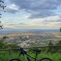
This is a short and sweet bicycle tour from the arboretum at the end of Huay Kaew Rd. to the Monthathan waterfall. The road leads through the Doi Suthep forest. It is fairly steep and continuously paved, so it can be done by road bike or mountain bike. The 1 hour climb (on a knobby tire mountain bike) provides a good cardio exercise and ends at a beautiful spot in the forest where the multileveled Monthan waterfall begins. This is one of the few spots where National Park entrance fee has to be paid at the park gate. It's well worth it.
- -:--
- Duration
- 5.8 km
- Distance
- 116 m
- Ascent
- 544 m
- Descent
- ---
- Avg. speed
- ---
- Avg. speed

Route quality
Waytypes & surfaces along the route
Waytypes
Busy road
3.7 km
(64 %)
Access road
2 km
(34 %)
Surfaces
Paved
5.8 km
(100 %)
Asphalt
3.7 km
(64 %)
Concrete
2 km
(34 %)
Route highlights
Points of interest along the route
Point of interest after 2.3 km
Park Gate
Continue with Bikemap
Use, edit, or download this cycling route
You would like to ride Monthathan Waterfall or customize it for your own trip? Here is what you can do with this Bikemap route:
Free features
- Save this route as favorite or in collections
- Copy & plan your own version of this route
- Sync your route with Garmin or Wahoo
Premium features
Free trial for 3 days, or one-time payment. More about Bikemap Premium.
- Navigate this route on iOS & Android
- Export a GPX / KML file of this route
- Create your custom printout (try it for free)
- Download this route for offline navigation
Discover more Premium features.
Get Bikemap PremiumFrom our community
Other popular routes starting in Chiang Mai
 Chiangmai U to Doi Su Thep view point
- Distance
- 18.1 km
- Ascent
- 404 m
- Descent
- 403 m
- Location
- Chiang Mai, Chiang Mai Province, Thailand
 Cycle in Thai 03 : Chiang Rai, Myanmar
- Distance
- 263.6 km
- Ascent
- 781 m
- Descent
- 703 m
- Location
- Chiang Mai, Chiang Mai Province, Thailand
 DoiSuthep
- Distance
- 49.9 km
- Ascent
- 1,107 m
- Descent
- 1,109 m
- Location
- Chiang Mai, Chiang Mai Province, Thailand
 straight to samoeng
- Distance
- 41.2 km
- Ascent
- 1,028 m
- Descent
- 849 m
- Location
- Chiang Mai, Chiang Mai Province, Thailand
 Phuping Palace
- Distance
- 52.2 km
- Ascent
- 1,083 m
- Descent
- 1,098 m
- Location
- Chiang Mai, Chiang Mai Province, Thailand
 MTCM - ITT Huay Tung Thao Lake
- Distance
- 8.3 km
- Ascent
- 72 m
- Descent
- 78 m
- Location
- Chiang Mai, Chiang Mai Province, Thailand
 CPB small circle
- Distance
- 13.7 km
- Ascent
- 73 m
- Descent
- 71 m
- Location
- Chiang Mai, Chiang Mai Province, Thailand
 Chiang Mai
- Distance
- 669.4 km
- Ascent
- 1,461 m
- Descent
- 1,461 m
- Location
- Chiang Mai, Chiang Mai Province, Thailand
Open it in the app