
RadlThon Stuttgart
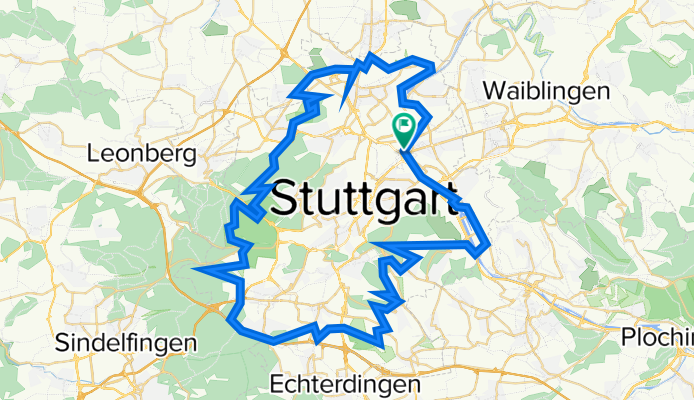
A cycling route starting in Stuttgart-Ost, Baden-Württemberg, Germany.
Overview
About this route
Radel-Thon-Strecke Stuttgart
- -:--
- Duration
- 80.1 km
- Distance
- 634 m
- Ascent
- 632 m
- Descent
- ---
- Avg. speed
- ---
- Avg. speed
Route quality
Waytypes & surfaces along the route
Waytypes
Track
37.9 km
(47 %)
Quiet road
13.1 km
(16 %)
Surfaces
Paved
51.6 km
(64 %)
Unpaved
24.1 km
(30 %)
Asphalt
47.3 km
(59 %)
Loose gravel
15 km
(19 %)
Continue with Bikemap
Use, edit, or download this cycling route
You would like to ride RadlThon Stuttgart or customize it for your own trip? Here is what you can do with this Bikemap route:
Free features
- Save this route as favorite or in collections
- Copy & plan your own version of this route
- Sync your route with Garmin or Wahoo
Premium features
Free trial for 3 days, or one-time payment. More about Bikemap Premium.
- Navigate this route on iOS & Android
- Export a GPX / KML file of this route
- Create your custom printout (try it for free)
- Download this route for offline navigation
Discover more Premium features.
Get Bikemap PremiumFrom our community
Other popular routes starting in Stuttgart-Ost
 SonntagsfahrerJubitour 2008
- Distance
- 15 km
- Ascent
- 380 m
- Descent
- 378 m
- Location
- Stuttgart-Ost, Baden-Württemberg, Germany
 BC - RT (3) - 98K
- Distance
- 98.5 km
- Ascent
- 0 m
- Descent
- 0 m
- Location
- Stuttgart-Ost, Baden-Württemberg, Germany
 stuttgart (südost-südwest-city)
- Distance
- 33 km
- Ascent
- 516 m
- Descent
- 516 m
- Location
- Stuttgart-Ost, Baden-Württemberg, Germany
 siebenmühlental
- Distance
- 49.2 km
- Ascent
- 513 m
- Descent
- 508 m
- Location
- Stuttgart-Ost, Baden-Württemberg, Germany
 Feierabendrunde
- Distance
- 39.1 km
- Ascent
- 494 m
- Descent
- 466 m
- Location
- Stuttgart-Ost, Baden-Württemberg, Germany
 Radtour WHBLT Dienstag
- Distance
- 64.7 km
- Ascent
- 1,274 m
- Descent
- 1,274 m
- Location
- Stuttgart-Ost, Baden-Württemberg, Germany
 Stuttgart-Remstal-Rundfahrt
- Distance
- 73.8 km
- Ascent
- 732 m
- Descent
- 713 m
- Location
- Stuttgart-Ost, Baden-Württemberg, Germany
 rotenberg - lederberg - zollberg
- Distance
- 40.6 km
- Ascent
- 647 m
- Descent
- 625 m
- Location
- Stuttgart-Ost, Baden-Württemberg, Germany
Open it in the app