

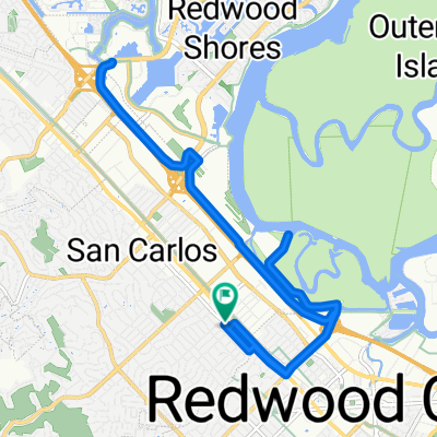
Bay Ride
A cycling route starting in San Carlos, California, United States.
Overview
About this route
7/23/13, 10:14 AM
- -:--
- Duration
- 29.1 km
- Distance
- 38 m
- Ascent
- 38 m
- Descent
- ---
- Avg. speed
- ---
- Max. altitude
Continue with Bikemap
Use, edit, or download this cycling route
You would like to ride Bay Ride or customize it for your own trip? Here is what you can do with this Bikemap route:
Free features
- Save this route as favorite or in collections
- Copy & plan your own version of this route
- Sync your route with Garmin or Wahoo
Premium features
Free trial for 3 days, or one-time payment. More about Bikemap Premium.
- Navigate this route on iOS & Android
- Export a GPX / KML file of this route
- Create your custom printout (try it for free)
- Download this route for offline navigation
Discover more Premium features.
Get Bikemap PremiumFrom our community
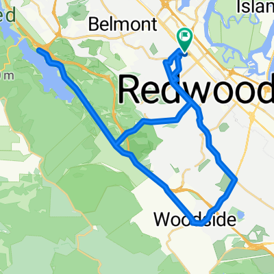
Other popular routes starting in San Carlos
 Home to Canada road
- Distance
- 17.2 km
- Ascent
- 305 m
- Descent
- 305 m
- Location
- San Carlos, California, United States
 Laurel Street 1438, San Carlos to Laurel Street 1495, San Carlos
- Distance
- 19.3 km
- Ascent
- 7 m
- Descent
- 8 m
- Location
- San Carlos, California, United States
 The Out and Back to Arastradero
- Distance
- 39.6 km
- Ascent
- 275 m
- Descent
- 269 m
- Location
- San Carlos, California, United States
 1348 Laurel St, San Carlos to 1348 Laurel St, San Carlos
- Distance
- 28.4 km
- Ascent
- 10 m
- Descent
- 15 m
- Location
- San Carlos, California, United States
 Roundtrip San Carlos, Redwood Shores, San Mateo
- Distance
- 25.9 km
- Ascent
- 21 m
- Descent
- 22 m
- Location
- San Carlos, California, United States
 Old County Rd, San Carlos a San Francisco Bay Trail, San Mateo
- Distance
- 15.3 km
- Ascent
- 75 m
- Descent
- 74 m
- Location
- San Carlos, California, United States
 963–995 Skyway Rd, San Carlos to San Francisco Bay Trail, Redwood City
- Distance
- 7.9 km
- Ascent
- 5 m
- Descent
- 5 m
- Location
- San Carlos, California, United States
 Easy ride in San Carlos
- Distance
- 39.5 km
- Ascent
- 495 m
- Descent
- 497 m
- Location
- San Carlos, California, United States
Open it in the app