Premium Badge Download on the App Store Get it on Google Play Turn-by-turn Navigation Offline Maps Bike Type Optimized Routing Premium Maps Custom Bike Computer Export Routes Route Previews Fall Detection Premium Support

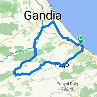
Cycling Route in Oliva, Valencia, Spain

oliva-rotova-terrateig-castellonet-gandia

2
Open this route in the Bikemap app

Open this route in the Bikemap app

Open this route in Bikemap Web

Open this route in Bikemap Web

61 km
Distance
823 m
Ascent
822 m
Descent
-:-- h
Duration
-- km/h
Avg. Speed
--- m
Max. Elevation

About This Route

Punto de partida: Oliva. Tiempo pedaleando: 6 h. 15 m. Dificultad técnica: Según tramos, desde “Facil” a “Solo expertos”. Dificultad física: Alta. La ruta consta de tres partes diferenciadas, la primera es un paseo por caminos agrícolas desde Rotova a Llocnou de Sant Jeroni, pasando por Almiserà, siguiendo el cauce del rio Vernissa que hay que cruzar en varias ocasiones con el consiguiente riesgo de no poder hacerlo si viene crecido. La segunda parte, bastante exigente, es una circular por la sierra de Terrateig por un forestal roto pero ciclable en su totalidad siguiendo la “Ruta per les Penyes Albes”, muy bien señalizada. Hay varias fuentes, zonas recreativas y lugares de interés para visitar. La tercera parte, reservada solo para expertos, va de Terrateig a Castellonet de la Conquesta por la Sierra de La Cuta, recientemente devastada por el fuego. El forestal esta muy roto y hay varios tramos no ciclables.

This cycling route is ideal for: MTB

You will cycle on the following surfaces: Unpaved Gravel

Customize this cycling route with the Bikemap route planner.

Make it yours!

Did you know? You can use this route as a template in our cycling route planner if you don't wish to start from scratch. Customize it based on your needs to plan your perfect cycling tour.

Open it in the app