

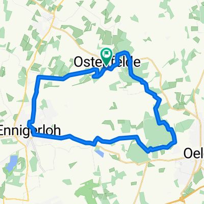
E'loh-Lette-Möhler.Oelde-E'loh
A cycling route starting in Ennigerloh, North Rhine-Westphalia, Germany.
Overview
About this route
Abendrunde
- -:--
- Duration
- 38.1 km
- Distance
- 117 m
- Ascent
- 117 m
- Descent
- ---
- Avg. speed
- ---
- Avg. speed

Route quality
Waytypes & surfaces along the route
Waytypes
Road
18.8 km
(49 %)
Quiet road
13.4 km
(35 %)
Surfaces
Paved
34 km
(89 %)
Asphalt
33.1 km
(87 %)
Paved (undefined)
0.9 km
(2 %)
Undefined
4.1 km
(11 %)
Continue with Bikemap
Use, edit, or download this cycling route
You would like to ride E'loh-Lette-Möhler.Oelde-E'loh or customize it for your own trip? Here is what you can do with this Bikemap route:
Free features
- Save this route as favorite or in collections
- Copy & plan your own version of this route
- Sync your route with Garmin or Wahoo
Premium features
Free trial for 3 days, or one-time payment. More about Bikemap Premium.
- Navigate this route on iOS & Android
- Export a GPX / KML file of this route
- Create your custom printout (try it for free)
- Download this route for offline navigation
Discover more Premium features.
Get Bikemap PremiumFrom our community
Other popular routes starting in Ennigerloh
 Fahrrad
- Distance
- 42.4 km
- Ascent
- 284 m
- Descent
- 284 m
- Location
- Ennigerloh, North Rhine-Westphalia, Germany
 Ennigerloh - Beelen - Warendorf - Freckenhorst - Ennigerloh
- Distance
- 56.3 km
- Ascent
- 126 m
- Descent
- 135 m
- Location
- Ennigerloh, North Rhine-Westphalia, Germany
 RR - Ahlen - Rinkerode - Hoetmar
- Distance
- 66.8 km
- Ascent
- 62 m
- Descent
- 61 m
- Location
- Ennigerloh, North Rhine-Westphalia, Germany
 Zementradroute Ennigerloh
- Distance
- 21.1 km
- Ascent
- 72 m
- Descent
- 74 m
- Location
- Ennigerloh, North Rhine-Westphalia, Germany
 Geisterholz mit MTB 20.01.2018
- Distance
- 22.4 km
- Ascent
- 133 m
- Descent
- 133 m
- Location
- Ennigerloh, North Rhine-Westphalia, Germany
 1000 jährige Eiche
- Distance
- 52.6 km
- Ascent
- 241 m
- Descent
- 242 m
- Location
- Ennigerloh, North Rhine-Westphalia, Germany
 Zementroute
- Distance
- 26 km
- Ascent
- 256 m
- Descent
- 250 m
- Location
- Ennigerloh, North Rhine-Westphalia, Germany
 Ennigerloh - Ostenfelde - Beelen - Ems - Westkirchen
- Distance
- 43.1 km
- Ascent
- 196 m
- Descent
- 196 m
- Location
- Ennigerloh, North Rhine-Westphalia, Germany
Open it in the app