

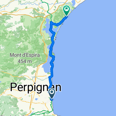
St Cyp - Pic Neoulous
A cycling route starting in Saint-Cyprien-Plage, Languedoc-Roussillon-Midi-Pyrénées, France.
Overview
About this route
von St.Cyp über Le Perthus auf den Pic Neoulous
- -:--
- Duration
- 48.2 km
- Distance
- 1,262 m
- Ascent
- 30 m
- Descent
- ---
- Avg. speed
- ---
- Avg. speed
Route quality
Waytypes & surfaces along the route
Waytypes
Road
23.7 km
(49 %)
Busy road
15.2 km
(32 %)
Surfaces
Paved
38.6 km
(80 %)
Asphalt
38.6 km
(80 %)
Undefined
9.5 km
(20 %)
Continue with Bikemap
Use, edit, or download this cycling route
You would like to ride St Cyp - Pic Neoulous or customize it for your own trip? Here is what you can do with this Bikemap route:
Free features
- Save this route as favorite or in collections
- Copy & plan your own version of this route
- Sync your route with Garmin or Wahoo
Premium features
Free trial for 3 days, or one-time payment. More about Bikemap Premium.
- Navigate this route on iOS & Android
- Export a GPX / KML file of this route
- Create your custom printout (try it for free)
- Download this route for offline navigation
Discover more Premium features.
Get Bikemap PremiumFrom our community
Other popular routes starting in Saint-Cyprien-Plage
 St. Cyp - Tour de Madeloc
- Distance
- 59.3 km
- Ascent
- 784 m
- Descent
- 784 m
- Location
- Saint-Cyprien-Plage, Languedoc-Roussillon-Midi-Pyrénées, France
 St Cyp - Col de Banyuls
- Distance
- 35.7 km
- Ascent
- 566 m
- Descent
- 206 m
- Location
- Saint-Cyprien-Plage, Languedoc-Roussillon-Midi-Pyrénées, France
 St Cyp - Caixas
- Distance
- 91.8 km
- Ascent
- 600 m
- Descent
- 601 m
- Location
- Saint-Cyprien-Plage, Languedoc-Roussillon-Midi-Pyrénées, France
 PERPIGNAN - SAN SEBASTIAN
- Distance
- 792.4 km
- Ascent
- 16,357 m
- Descent
- 16,357 m
- Location
- Saint-Cyprien-Plage, Languedoc-Roussillon-Midi-Pyrénées, France
 St. Cyp - Tour de Madeloc
- Distance
- 59.2 km
- Ascent
- 740 m
- Descent
- 740 m
- Location
- Saint-Cyprien-Plage, Languedoc-Roussillon-Midi-Pyrénées, France
 CO09 St Cyprien Plage - Narbonne Plage
- Distance
- 83.6 km
- Ascent
- 75 m
- Descent
- 74 m
- Location
- Saint-Cyprien-Plage, Languedoc-Roussillon-Midi-Pyrénées, France
 St Cyp-Argeles-Boulou
- Distance
- 54.3 km
- Ascent
- 118 m
- Descent
- 120 m
- Location
- Saint-Cyprien-Plage, Languedoc-Roussillon-Midi-Pyrénées, France
 pireneler
- Distance
- 1,681.1 km
- Ascent
- 21,086 m
- Descent
- 20,985 m
- Location
- Saint-Cyprien-Plage, Languedoc-Roussillon-Midi-Pyrénées, France
Open it in the app