

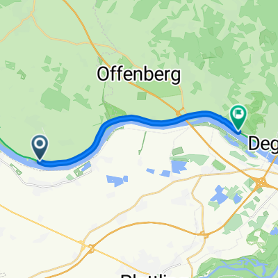
Neuhausen - Frauenau
A cycling route starting in Metten, Bavaria, Germany.
Overview
About this route
Neuhausen - Schaufling - Bischofsmais - Kirchberg - Frauenau
- -:--
- Duration
- 59.1 km
- Distance
- 1,156 m
- Ascent
- 862 m
- Descent
- ---
- Avg. speed
- ---
- Avg. speed
Route quality
Waytypes & surfaces along the route
Waytypes
Busy road
23.8 km
(40 %)
Road
22.6 km
(38 %)
Surfaces
Paved
54.6 km
(92 %)
Unpaved
0.2 km
(<1 %)
Asphalt
54.2 km
(92 %)
Paved (undefined)
0.4 km
(<1 %)
Continue with Bikemap
Use, edit, or download this cycling route
You would like to ride Neuhausen - Frauenau or customize it for your own trip? Here is what you can do with this Bikemap route:
Free features
- Save this route as favorite or in collections
- Copy & plan your own version of this route
- Sync your route with Garmin or Wahoo
Premium features
Free trial for 3 days, or one-time payment. More about Bikemap Premium.
- Navigate this route on iOS & Android
- Export a GPX / KML file of this route
- Create your custom printout (try it for free)
- Download this route for offline navigation
Discover more Premium features.
Get Bikemap PremiumFrom our community
Other popular routes starting in Metten
 Sünching
- Distance
- 112.7 km
- Ascent
- 141 m
- Descent
- 141 m
- Location
- Metten, Bavaria, Germany
 20230509_01, Tour 04, Metten-Fähre Mariaposching
- Distance
- 12 km
- Ascent
- 17 m
- Descent
- 22 m
- Location
- Metten, Bavaria, Germany
 EuroVelo 6 - Atlantic-Black Sea - part Germany - Bavaria
- Distance
- 10.3 km
- Ascent
- 22 m
- Descent
- 24 m
- Location
- Metten, Bavaria, Germany
 Genußrunde
- Distance
- 98.5 km
- Ascent
- 204 m
- Descent
- 205 m
- Location
- Metten, Bavaria, Germany
 Rute 1
- Distance
- 8.7 km
- Ascent
- 524 m
- Descent
- 284 m
- Location
- Metten, Bavaria, Germany
 Kurze Sonntagsrunde
- Distance
- 44.6 km
- Ascent
- 60 m
- Descent
- 66 m
- Location
- Metten, Bavaria, Germany
 Vogelsang, Klosterstein und Rgb.-Stein
- Distance
- 32 km
- Ascent
- 1,018 m
- Descent
- 1,014 m
- Location
- Metten, Bavaria, Germany
 Wörth a. d. Donau
- Distance
- 122.8 km
- Ascent
- 93 m
- Descent
- 91 m
- Location
- Metten, Bavaria, Germany
Open it in the app