

BP-Emmerwiesen-GB-Deitlevsen 25 km
A cycling route starting in Bad Pyrmont, Lower Saxony, Germany.
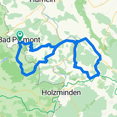
Overview
About this route
Schwere, aber kurze Strecke. Aus dem Pyrmonter Tal hinauf zur Ottensteiner Hochebene. Die schwerere, aber auch kürzere Variante über Lügde. Nach der einen schweren Steigung, leichtes Rolle von Kleinenberg über die Windmühle nach Lichtenhagen, von wo aus es in landschaftlich reizvoller Umgebung bis nach Welsede bergab zu fahren geht. Rest ist nur noch markulatur, auf dem Radweg nach Bad Pyrmont zurück.
(cloned from route 282187)- -:--
- Duration
- 32.3 km
- Distance
- 348 m
- Ascent
- 349 m
- Descent
- ---
- Avg. speed
- ---
- Avg. speed
Route quality
Waytypes & surfaces along the route
Waytypes
Road
10 km
(31 %)
Path
7.5 km
(23 %)
Surfaces
Paved
26.3 km
(81 %)
Unpaved
0.6 km
(2 %)
Asphalt
20.2 km
(63 %)
Paving stones
5.8 km
(18 %)
Continue with Bikemap
Use, edit, or download this cycling route
You would like to ride BP-Emmerwiesen-GB-Deitlevsen 25 km or customize it for your own trip? Here is what you can do with this Bikemap route:
Free features
- Save this route as favorite or in collections
- Copy & plan your own version of this route
- Sync your route with Garmin or Wahoo
Premium features
Free trial for 3 days, or one-time payment. More about Bikemap Premium.
- Navigate this route on iOS & Android
- Export a GPX / KML file of this route
- Create your custom printout (try it for free)
- Download this route for offline navigation
Discover more Premium features.
Get Bikemap PremiumFrom our community
Other popular routes starting in Bad Pyrmont
 21 km Bad Pyrmont Waldweg
- Distance
- 21.9 km
- Ascent
- 478 m
- Descent
- 483 m
- Location
- Bad Pyrmont, Lower Saxony, Germany
 Bad Pyrmont-Rühler-Schweiz
- Distance
- 106.7 km
- Ascent
- 1,293 m
- Descent
- 1,239 m
- Location
- Bad Pyrmont, Lower Saxony, Germany
 Halbe Runde um Bad Pyrmont
- Distance
- 30.8 km
- Ascent
- 444 m
- Descent
- 443 m
- Location
- Bad Pyrmont, Lower Saxony, Germany
 Holzhausen-Meinte-Eschenbruch-Hagen-Holzhausen
- Distance
- 28.3 km
- Ascent
- 476 m
- Descent
- 471 m
- Location
- Bad Pyrmont, Lower Saxony, Germany
 Langer Grund-Schellenturm-Hagen -Holzhausen August 2013
- Distance
- 26.7 km
- Ascent
- 441 m
- Descent
- 437 m
- Location
- Bad Pyrmont, Lower Saxony, Germany
 MTB - Bad Pyrmont Hohe Stolle- Grenzweg-Schlangenweg
- Distance
- 15.5 km
- Ascent
- 353 m
- Descent
- 342 m
- Location
- Bad Pyrmont, Lower Saxony, Germany
 Bad Pyrmont-Ostwestfalenstraße-Köterberg
- Distance
- 86.1 km
- Ascent
- 757 m
- Descent
- 757 m
- Location
- Bad Pyrmont, Lower Saxony, Germany
 Von Pyrmont nach Plön und nach Pyrmont zurück
- Distance
- 740.7 km
- Ascent
- 622 m
- Descent
- 637 m
- Location
- Bad Pyrmont, Lower Saxony, Germany
Open it in the app