

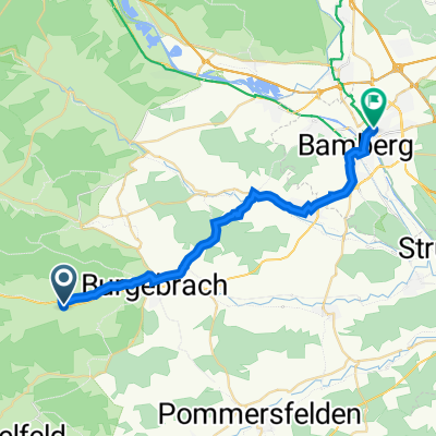
Burgebrach - Gchsheim
A cycling route starting in Burgebrach, Bavaria, Germany.
Overview
About this route
One way .. I get lost in wald between Ebrach and Handtal .. sipmle rule "go strigth" was too complicated.
- -:--
- Duration
- 40.8 km
- Distance
- 327 m
- Ascent
- 387 m
- Descent
- ---
- Avg. speed
- ---
- Avg. speed
Route quality
Waytypes & surfaces along the route
Waytypes
Path
15.6 km
(38 %)
Track
13 km
(32 %)
Surfaces
Paved
28.5 km
(70 %)
Unpaved
9.2 km
(23 %)
Asphalt
25.7 km
(63 %)
Gravel
7.1 km
(17 %)
Continue with Bikemap
Use, edit, or download this cycling route
You would like to ride Burgebrach - Gchsheim or customize it for your own trip? Here is what you can do with this Bikemap route:
Free features
- Save this route as favorite or in collections
- Copy & plan your own version of this route
- Sync your route with Garmin or Wahoo
Premium features
Free trial for 3 days, or one-time payment. More about Bikemap Premium.
- Navigate this route on iOS & Android
- Export a GPX / KML file of this route
- Create your custom printout (try it for free)
- Download this route for offline navigation
Discover more Premium features.
Get Bikemap PremiumFrom our community
Other popular routes starting in Burgebrach
 Mönchsambach 24, Burgebrach nach Ludwigstraße 6, Bamberg
- Distance
- 23.3 km
- Ascent
- 168 m
- Descent
- 205 m
- Location
- Burgebrach, Bavaria, Germany
 burgerach mühlhausen
- Distance
- 9.3 km
- Ascent
- 163 m
- Descent
- 164 m
- Location
- Burgebrach, Bavaria, Germany
 Burgebrach - Gchsheim
- Distance
- 40.8 km
- Ascent
- 327 m
- Descent
- 387 m
- Location
- Burgebrach, Bavaria, Germany
 Burgebrach nach Grabengrundstraße 1, Schlüsselfeld
- Distance
- 16.3 km
- Ascent
- 261 m
- Descent
- 266 m
- Location
- Burgebrach, Bavaria, Germany
 MTB Grasmannsdorf Steigerwald
- Distance
- 27.5 km
- Ascent
- 312 m
- Descent
- 310 m
- Location
- Burgebrach, Bavaria, Germany
 Bierkeller Erkundung
- Distance
- 10.6 km
- Ascent
- 88 m
- Descent
- 89 m
- Location
- Burgebrach, Bavaria, Germany
 Burgebrach-Viereth-Eltmann-Oberschlaichach-Lisberg-Steinsdorf-Burgebrach
- Distance
- 58.9 km
- Ascent
- 430 m
- Descent
- 433 m
- Location
- Burgebrach, Bavaria, Germany
 Bürgebrach-Lisberg-Dankenfeld- Schönbrunn-Burgebrach
- Distance
- 32.5 km
- Ascent
- 315 m
- Descent
- 315 m
- Location
- Burgebrach, Bavaria, Germany
Open it in the app