

Rheinischer Esel 2.0
A cycling route starting in Dortmund, North Rhine-Westphalia, Germany.
Overview
About this route
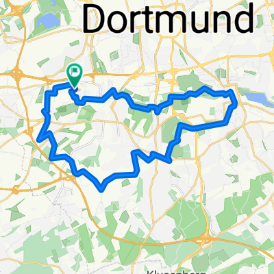
Erste Runde im neuen Jahr. Eigentlich sollte es nur eine kleine Runde werden. Am Ende waren es über 32 km. Meine Oberschenkel haben mehrfach richtig zu gemacht, so dass ich nicht einmal stehen konnte. Daher auch die langsamer Geschwindigkeit am Ende.
Die Runde über den rheinischen Esel ist schon toll. Man merkt sofort, wenn man in Witten ist, wo man wert auf gute Radwege legt. Warum ein Stück des rheinischen Esels gesperrt war, weiß ich nicht, bin trotzdem da weiter gefahren. Besonders toll fand ich die Informationstafeln über die Planeten. Die kann ich sehr empfehlen! Die Auffahrt Stockum, die ja neu gemacht wurde, ist ja irgendwo für die Tonne. Man erkennt ja, wie weit ich länger fahren musste, um die Ausfahrt nach Stockum zu nehmen. Sinnvoll ist das nicht. Trotzdem der rheinische Esel ist einfach klasse. Für mich in der Nähe der beste Radweg.- -:--
- Duration
- 32.7 km
- Distance
- 175 m
- Ascent
- 178 m
- Descent
- ---
- Avg. speed
- ---
- Avg. speed

Continue with Bikemap
Use, edit, or download this cycling route
You would like to ride Rheinischer Esel 2.0 or customize it for your own trip? Here is what you can do with this Bikemap route:
Free features
- Save this route as favorite or in collections
- Copy & plan your own version of this route
- Sync your route with Garmin or Wahoo
Premium features
Free trial for 3 days, or one-time payment. More about Bikemap Premium.
- Navigate this route on iOS & Android
- Export a GPX / KML file of this route
- Create your custom printout (try it for free)
- Download this route for offline navigation
Discover more Premium features.
Get Bikemap PremiumFrom our community
Other popular routes starting in Dortmund
 Route Eving, Brechten und Lünen
- Distance
- 20.3 km
- Ascent
- 7 m
- Descent
- 11 m
- Location
- Dortmund, North Rhine-Westphalia, Germany
 Dortmund-Süd, Route 3 von 5
- Distance
- 25.9 km
- Ascent
- 300 m
- Descent
- 297 m
- Location
- Dortmund, North Rhine-Westphalia, Germany
 Wambel - Hohensyburg
- Distance
- 18 km
- Ascent
- 0 m
- Descent
- 0 m
- Location
- Dortmund, North Rhine-Westphalia, Germany
 Dortmund-Emscherquelle-Kamen-Dortmund
- Distance
- 67.3 km
- Ascent
- 213 m
- Descent
- 206 m
- Location
- Dortmund, North Rhine-Westphalia, Germany
 Wellinghofer RTF 41km-Strecke
- Distance
- 39.2 km
- Ascent
- 309 m
- Descent
- 309 m
- Location
- Dortmund, North Rhine-Westphalia, Germany
 Rund um den Dortmunder Süden
- Distance
- 61.4 km
- Ascent
- 313 m
- Descent
- 313 m
- Location
- Dortmund, North Rhine-Westphalia, Germany
 Dortmund-West, Tour 5 von 5
- Distance
- 24.5 km
- Ascent
- 148 m
- Descent
- 148 m
- Location
- Dortmund, North Rhine-Westphalia, Germany
 Feierabendrunde Dortmunder Westen
- Distance
- 22.1 km
- Ascent
- 111 m
- Descent
- 107 m
- Location
- Dortmund, North Rhine-Westphalia, Germany
Open it in the app