

running around Rifugio della Poiane
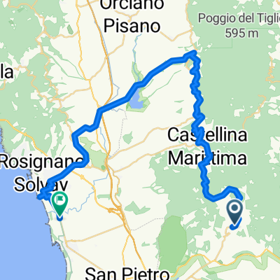
A cycling route starting in Riparbella, Tuscany, Italy.
Overview
About this route
Szállás egy valódi agriturismoban, reggeli futással összekötve
- -:--
- Duration
- 0.6 km
- Distance
- 46 m
- Ascent
- 10 m
- Descent
- ---
- Avg. speed
- ---
- Avg. speed
Route quality
Waytypes & surfaces along the route
Waytypes
Track
0.6 km
(100 %)
Surfaces
Unpaved
0.6 km
(100 %)
Unpaved (undefined)
0.6 km
(100 %)
Continue with Bikemap
Use, edit, or download this cycling route
You would like to ride running around Rifugio della Poiane or customize it for your own trip? Here is what you can do with this Bikemap route:
Free features
- Save this route as favorite or in collections
- Copy & plan your own version of this route
- Sync your route with Garmin or Wahoo
Premium features
Free trial for 3 days, or one-time payment. More about Bikemap Premium.
- Navigate this route on iOS & Android
- Export a GPX / KML file of this route
- Create your custom printout (try it for free)
- Download this route for offline navigation
Discover more Premium features.
Get Bikemap PremiumFrom our community
Other popular routes starting in Riparbella
 Route_2_43.4km
- Distance
- 43.4 km
- Ascent
- 398 m
- Descent
- 604 m
- Location
- Riparbella, Tuscany, Italy
 Borgo San Pecoraio - Riparbella - Castellina Marittima - Cecina - Riparbella - Borgo San Pecoraio
- Distance
- 39.7 km
- Ascent
- 554 m
- Descent
- 554 m
- Location
- Riparbella, Tuscany, Italy
 Strada senza nome, Riparbella - Via Carpena di Marinasco 1, La Spezia
- Distance
- 239.3 km
- Ascent
- 3,322 m
- Descent
- 3,267 m
- Location
- Riparbella, Tuscany, Italy
 Riparbella revisted 51 km
- Distance
- 50.8 km
- Ascent
- 493 m
- Descent
- 493 m
- Location
- Riparbella, Tuscany, Italy
 Tag 2. Riparbella - Sassa - Castagnetto Carducci - Bibbona - Rip
- Distance
- 92.2 km
- Ascent
- 1,002 m
- Descent
- 1,004 m
- Location
- Riparbella, Tuscany, Italy
 non mi rompere le pale
- Distance
- 25.2 km
- Ascent
- 543 m
- Descent
- 543 m
- Location
- Riparbella, Tuscany, Italy
 San Martino - Volterra- Montecatini - San Martino (agr. Le Serre)
- Distance
- 90 km
- Ascent
- 1,091 m
- Descent
- 1,089 m
- Location
- Riparbella, Tuscany, Italy
 2023_Toscana_Gi_Lari
- Distance
- 111.8 km
- Ascent
- 1,661 m
- Descent
- 1,661 m
- Location
- Riparbella, Tuscany, Italy
Open it in the app