Premium Badge Download on the App Store Get it on Google Play Turn-by-turn Navigation Offline Maps Bike Type Optimized Routing Premium Maps Custom Bike Computer Export Routes Route Previews Fall Detection Premium Support

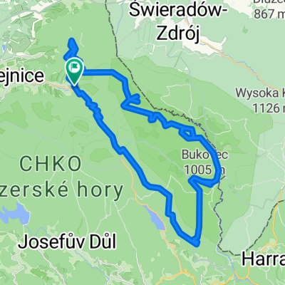
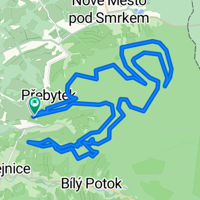
Cycling Route in Hejnice, Liberecký kraj, Czechia

2013-08-17 Isergebirge - Elbbaude

1
Open this route in the Bikemap app

Open this route in the Bikemap app

Open this route in Bikemap Web

Open this route in Bikemap Web

130 km
Distance
2340 m
Ascent
2340 m
Descent
-:-- h
Duration
-- km/h
Avg. Speed
--- m
Max. Elevation

About This Route

Start an der Basilika von Hejnice am Fuße des Isergebirges, erste Passhöhe des Tages ist der Smedavapass (847m), weiter durch das idyllische, östliche Hochland des Isergebirges (850-900m). Dem Iserfluss (Jizera) talwärts folgend bis zum Örtchen Rokytnice. Von hier hinauf zum Berghotel "Rezek" (880m) und gleich wieder hinunter ins Nachbartal der kleinen Iser (Jizerka). Jetzt geht es nur noch bergauf: zuerst zum Skiort Horny Misecky (1000m) und weiter auf der Serpentinenstraße zur Vrbatovbaude auf 1400m. Beeindruckt vom alpinen Bergpanorama des Riesengebirges kann man noch auf asphaltiertem Weg zur Elbbaude rollen (1300m). Zurück gehts wieder über die beiden Buckel auf zumeist identischer Strecke.

Ebene Abschnitte gabs heute nicht. Die 129km sind bei mehr als 2700 Höhenmetern und 5 Passhöhen (für mich) sehr anspruchsvoll (nur 18er Schnitt!!!). Dafür ist die Gegend wirklich schick.

This cycling route is ideal for: Road bike

You will cycle on the following surfaces: Paved

Customize this cycling route with the Bikemap route planner.

Make it yours!

Did you know? You can use this route as a template in our cycling route planner if you don't wish to start from scratch. Customize it based on your needs to plan your perfect cycling tour.

Open it in the app