

Starý Smokovec - Grüner Bergsee
A cycling route starting in Vysoké Tatry, Prešovský kraj, Slovak Republic.
Overview
About this route
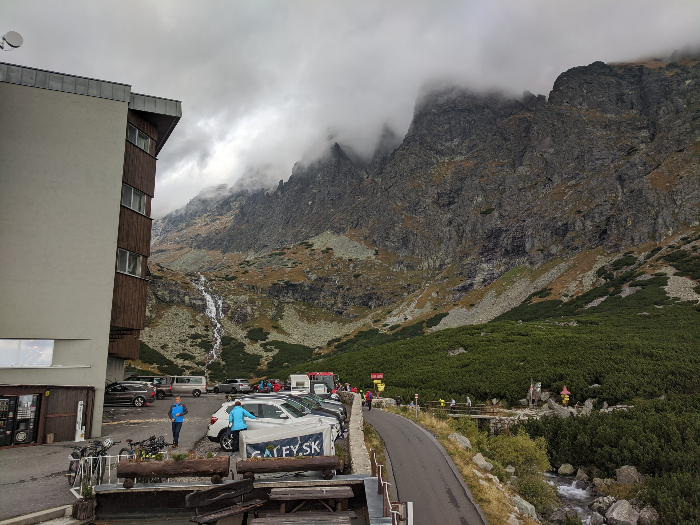
Die anspruchsvollste Radtour in der Hohen Tatra, die besonders für Mountainbike geeignet ist. Die Route verläuft am Anfang auf normalen Straßen bis zur Bushaltestelle Biela voda. Hier fängt ein anspruchsvoller und steiler Radweg an (unbefestigt, Schotter, teilweise lockere Steine) bis zum Bergsee Zelené Pleso (1545 m).
Interessante Orte an der Route: Starý Smokovec (Altschmecks): Anfangs- und Zielort, das älteste touristische Erholungszentrum der Hohen Tatra (1793) Tatranská Lomnica (Tatralomnitz): TANAP-Museum, Seilbahn zum Bergsee Skalnaté Pleso (Steinbachsee), Gondelbahn zur Lomnitzer Spitze, Wintersportzentrum Zelené Pleso (Grüner See): 1545 m, 1,78 ha, 4,5 m tief, Berghütte (1551), Ausgangspunkt zur Lammspitze (2229,6 m) - -:--
- Duration
- 32.6 km
- Distance
- 880 m
- Ascent
- 880 m
- Descent
- ---
- Avg. speed
- ---
- Avg. speed

Continue with Bikemap
Use, edit, or download this cycling route
You would like to ride Starý Smokovec - Grüner Bergsee or customize it for your own trip? Here is what you can do with this Bikemap route:
Free features
- Save this route as favorite or in collections
- Copy & plan your own version of this route
- Sync your route with Garmin or Wahoo
Premium features
Free trial for 3 days, or one-time payment. More about Bikemap Premium.
- Navigate this route on iOS & Android
- Export a GPX / KML file of this route
- Create your custom printout (try it for free)
- Download this route for offline navigation
Discover more Premium features.
Get Bikemap PremiumFrom our community
Other popular routes starting in Vysoké Tatry
 Skalnaté pleso-1krát
- Distance
- 4.2 km
- Ascent
- 857 m
- Descent
- 0 m
- Location
- Vysoké Tatry, Prešovský kraj, Slovak Republic
 ALPOK EXPEDÍCIÓ (2015) -1. nap - Szombat
- Distance
- 215.9 km
- Ascent
- 2,013 m
- Descent
- 2,358 m
- Location
- Vysoké Tatry, Prešovský kraj, Slovak Republic
 Sliezsky dom z Polianky
- Distance
- 6.7 km
- Ascent
- 733 m
- Descent
- 91 m
- Location
- Vysoké Tatry, Prešovský kraj, Slovak Republic
 Vysoké Tatry do Poštová 4023, Vysoké Tatry
- Distance
- 20.6 km
- Ascent
- 569 m
- Descent
- 127 m
- Location
- Vysoké Tatry, Prešovský kraj, Slovak Republic
 Tour de Zelené pleso
- Distance
- 22.6 km
- Ascent
- 725 m
- Descent
- 725 m
- Location
- Vysoké Tatry, Prešovský kraj, Slovak Republic
 VT - nakolo blizsie :D
- Distance
- 21.8 km
- Ascent
- 1,489 m
- Descent
- 1,490 m
- Location
- Vysoké Tatry, Prešovský kraj, Slovak Republic
 Tatranská Lomnica, Mlynica, Burich, Dolný Smokovec, Tatranská Lomnica (2)
- Distance
- 25.2 km
- Ascent
- 310 m
- Descent
- 310 m
- Location
- Vysoké Tatry, Prešovský kraj, Slovak Republic
 Día 5. Stary Smokovec - Liptovsky Mikulas
- Distance
- 85.4 km
- Ascent
- 467 m
- Descent
- 904 m
- Location
- Vysoké Tatry, Prešovský kraj, Slovak Republic
Open it in the app