

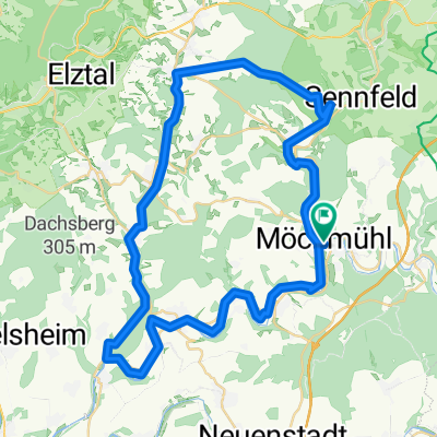
Möckmühl - Aschaffenburg
A cycling route starting in Möckmühl, Baden-Württemberg, Germany.
Overview
About this route
Teil 2 der Route nach Aschaffenburg an Jagst und Neckar und durch den Odenwald zum Main
- -:--
- Duration
- 160.5 km
- Distance
- 597 m
- Ascent
- 641 m
- Descent
- ---
- Avg. speed
- ---
- Avg. speed

Route quality
Waytypes & surfaces along the route
Waytypes
Busy road
96.7 km
(60 %)
Road
22.7 km
(14 %)
Surfaces
Paved
137.3 km
(86 %)
Unpaved
0.6 km
(<1 %)
Asphalt
135.5 km
(84 %)
Paving stones
1.4 km
(<1 %)
Continue with Bikemap
Use, edit, or download this cycling route
You would like to ride Möckmühl - Aschaffenburg or customize it for your own trip? Here is what you can do with this Bikemap route:
Free features
- Save this route as favorite or in collections
- Copy & plan your own version of this route
- Sync your route with Garmin or Wahoo
Premium features
Free trial for 3 days, or one-time payment. More about Bikemap Premium.
- Navigate this route on iOS & Android
- Export a GPX / KML file of this route
- Create your custom printout (try it for free)
- Download this route for offline navigation
Discover more Premium features.
Get Bikemap PremiumFrom our community
Other popular routes starting in Möckmühl
 Auf der Hohen Straße zwischen Kocher- und Jagsttal
- Distance
- 50.2 km
- Ascent
- 358 m
- Descent
- 358 m
- Location
- Möckmühl, Baden-Württemberg, Germany
 3 Bäche Tour
- Distance
- 51.6 km
- Ascent
- 281 m
- Descent
- 282 m
- Location
- Möckmühl, Baden-Württemberg, Germany
 Möckmühl/Jagst Mulfingen/Bartenstein - Schrozberg - Weikersheim/Tauber - Beckstein - Boxberg - Osterburken/Seckach - Möckmühl
- Distance
- 163.6 km
- Ascent
- 547 m
- Descent
- 547 m
- Location
- Möckmühl, Baden-Württemberg, Germany
 2nd_MoMu_LB
- Distance
- 107.8 km
- Ascent
- 743 m
- Descent
- 626 m
- Location
- Möckmühl, Baden-Württemberg, Germany
 Möckmühl-Aschaffenburg
- Distance
- 90.6 km
- Ascent
- 337 m
- Descent
- 406 m
- Location
- Möckmühl, Baden-Württemberg, Germany
 Jagst zur Tauber
- Distance
- 108.8 km
- Ascent
- 550 m
- Descent
- 540 m
- Location
- Möckmühl, Baden-Württemberg, Germany
 RD_BadMergentheim_Mockmuehl_KM55
- Distance
- 55 km
- Ascent
- 622 m
- Descent
- 585 m
- Location
- Möckmühl, Baden-Württemberg, Germany
 Möckmül - Jagsthausen - Sindringen
- Distance
- 13.3 km
- Ascent
- 137 m
- Descent
- 111 m
- Location
- Möckmühl, Baden-Württemberg, Germany
Open it in the app