
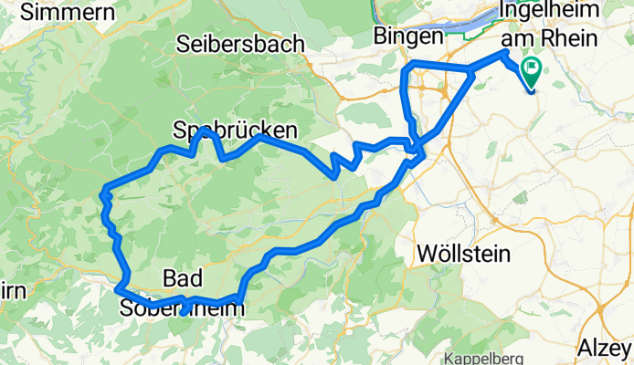
Schinderhannes Tour
A cycling route starting in Appenheim, Rhineland-Palatinate, Germany.
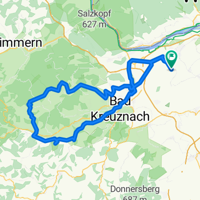
Overview
About this route
Relativ flache Tour um den Soonwald, mit Abstechern zum Freilichtmuseum und zur Schinderhanneshöhle
- -:--
- Duration
- 117.6 km
- Distance
- 633 m
- Ascent
- 635 m
- Descent
- ---
- Avg. speed
- ---
- Avg. speed
Route quality
Waytypes & surfaces along the route
Waytypes
Busy road
55.1 km
(47 %)
Track
16.3 km
(14 %)
Surfaces
Paved
84.7 km
(72 %)
Unpaved
5.3 km
(4 %)
Asphalt
81.9 km
(70 %)
Ground
3.1 km
(3 %)
Continue with Bikemap
Use, edit, or download this cycling route
You would like to ride Schinderhannes Tour or customize it for your own trip? Here is what you can do with this Bikemap route:
Free features
- Save this route as favorite or in collections
- Copy & plan your own version of this route
- Sync your route with Garmin or Wahoo
Premium features
Free trial for 3 days, or one-time payment. More about Bikemap Premium.
- Navigate this route on iOS & Android
- Export a GPX / KML file of this route
- Create your custom printout (try it for free)
- Download this route for offline navigation
Discover more Premium features.
Get Bikemap PremiumFrom our community
Other popular routes starting in Appenheim
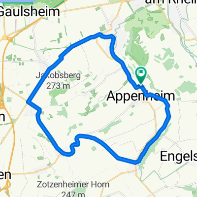 Rund um den Laurenziberg
- Distance
- 21.7 km
- Ascent
- 150 m
- Descent
- 191 m
- Location
- Appenheim, Rhineland-Palatinate, Germany
 048d: Ingelheim - Gensingen - Hergenfeld - Schöneberg - Trollbachtal - Ingelheim
- Distance
- 64 km
- Ascent
- 561 m
- Descent
- 561 m
- Location
- Appenheim, Rhineland-Palatinate, Germany
 048a: Ingelheim - Gensingen - Allenfeld - Spall - Schöneberg - Trollbachtal - Ingelheim
- Distance
- 81.2 km
- Ascent
- 682 m
- Descent
- 680 m
- Location
- Appenheim, Rhineland-Palatinate, Germany
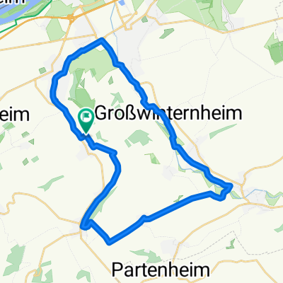 Welzbach - Selztal Runde
- Distance
- 27.5 km
- Ascent
- 133 m
- Descent
- 185 m
- Location
- Appenheim, Rhineland-Palatinate, Germany
 Schinderhannes Tour
- Distance
- 117.6 km
- Ascent
- 633 m
- Descent
- 635 m
- Location
- Appenheim, Rhineland-Palatinate, Germany
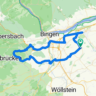
 Bad Münster Tour
- Distance
- 59.2 km
- Ascent
- 595 m
- Descent
- 596 m
- Location
- Appenheim, Rhineland-Palatinate, Germany
 048c: Ingelheim - Gensingen - Dalberg - Schöneberg - Trollbachtal - Ingelheim
- Distance
- 70.6 km
- Ascent
- 630 m
- Descent
- 630 m
- Location
- Appenheim, Rhineland-Palatinate, Germany
 048b: Ingelheim - Gensingen - Argenschwang - Schöneberg - Trollbachtal - Ingelheim
- Distance
- 74.1 km
- Ascent
- 638 m
- Descent
- 638 m
- Location
- Appenheim, Rhineland-Palatinate, Germany
Open it in the app