

Neverland/Figueroa
A cycling route starting in Santa Ynez, California, United States of America.
Overview
About this route
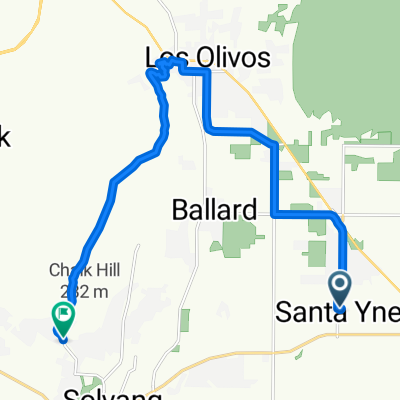
This amazing routes. Starting in Santa Inez allows you legs to warm up for this demanding ride. Los Olivos past Micheal Jackson's Neverland property climbing up a series of demanding switchbacks and into the park. The road narrows and some uneven pavement. Following the ridge along and climbing even higher. The descent begins on some rough paved then drop into some of the sweet road... a small climb.. then 1k of "HARD PACK UNPAVED" Happy Valley canyon is seductive. Go spin... We stayed with bike friendly "The Shady Oak" 2br w/ kitchen.
- -:--
- Duration
- 65.4 km
- Distance
- 1,910 m
- Ascent
- 1,929 m
- Descent
- ---
- Avg. speed
- 1,388 m
- Avg. speed

Route quality
Waytypes & surfaces along the route
Waytypes
Quiet road
53 km
(81 %)
Busy road
6.7 km
(10 %)
Surfaces
Paved
25.8 km
(39 %)
Paved (undefined)
17.1 km
(26 %)
Asphalt
7.7 km
(12 %)
Continue with Bikemap
Use, edit, or download this cycling route
You would like to ride Neverland/Figueroa or customize it for your own trip? Here is what you can do with this Bikemap route:
Free features
- Save this route as favorite or in collections
- Copy & plan your own version of this route
- Sync your route with Garmin or Wahoo
Premium features
Free trial for 3 days, or one-time payment. More about Bikemap Premium.
- Navigate this route on iOS & Android
- Export a GPX / KML file of this route
- Create your custom printout (try it for free)
- Download this route for offline navigation
Discover more Premium features.
Get Bikemap PremiumFrom our community
Other popular routes starting in Santa Ynez
 Slow ride in Santa Ynez
- Distance
- 23.9 km
- Ascent
- 601 m
- Descent
- 644 m
- Location
- Santa Ynez, California, United States of America
 3558 Sagunto St, Santa Ynez to 2900 Nojoqui Ave, Los Olivos
- Distance
- 14.9 km
- Ascent
- 139 m
- Descent
- 73 m
- Location
- Santa Ynez, California, United States of America
 Roblar-Rotonda
- Distance
- 20.1 km
- Ascent
- 156 m
- Descent
- 159 m
- Location
- Santa Ynez, California, United States of America
 Santa Ynez Long
- Distance
- 68 km
- Ascent
- 1,257 m
- Descent
- 1,255 m
- Location
- Santa Ynez, California, United States of America
 3631 Sagunto St, Santa Ynez to 2920 Grand Ave, Los Olivos
- Distance
- 10.3 km
- Ascent
- 96 m
- Descent
- 33 m
- Location
- Santa Ynez, California, United States of America
 Supersonic route in Solvang
- Distance
- 18.2 km
- Ascent
- 485 m
- Descent
- 505 m
- Location
- Santa Ynez, California, United States of America
 Supersonic route in Santa Ynez
- Distance
- 17.8 km
- Ascent
- 145 m
- Descent
- 147 m
- Location
- Santa Ynez, California, United States of America
 lake cachuma - carpinteria state beach
- Distance
- 60.8 km
- Ascent
- 879 m
- Descent
- 1,115 m
- Location
- Santa Ynez, California, United States of America
Open it in the app