

Sarajevo-Bijambare-Misoca-ilijas-Sa
A cycling route starting in Sarajevo, Federation of Bosnia and Herzegovina, Bosnia and Herzegovina.
Overview
About this route
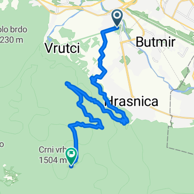
Sarajevo preko Vucije Luke, Ozrena, Homar, Gajevi, Bijambare, Kamenica, Okruglica, kanjon Misoce, Ilijas, Sarajevo
- -:--
- Duration
- 116.7 km
- Distance
- 1,317 m
- Ascent
- 1,309 m
- Descent
- ---
- Avg. speed
- ---
- Avg. speed

Route quality
Waytypes & surfaces along the route
Waytypes
Quiet road
83.8 km
(72 %)
Busy road
19.2 km
(16 %)
Surfaces
Paved
28.7 km
(25 %)
Unpaved
53.2 km
(46 %)
Gravel
50.1 km
(43 %)
Asphalt
28.7 km
(25 %)
Continue with Bikemap
Use, edit, or download this cycling route
You would like to ride Sarajevo-Bijambare-Misoca-ilijas-Sa or customize it for your own trip? Here is what you can do with this Bikemap route:
Free features
- Save this route as favorite or in collections
- Copy & plan your own version of this route
- Sync your route with Garmin or Wahoo
Premium features
Free trial for 3 days, or one-time payment. More about Bikemap Premium.
- Navigate this route on iOS & Android
- Export a GPX / KML file of this route
- Create your custom printout (try it for free)
- Download this route for offline navigation
Discover more Premium features.
Get Bikemap PremiumFrom our community
Other popular routes starting in Sarajevo
 lukavica>tvrdimići>jasik&>brus>bistrik kula
- Distance
- 45.3 km
- Ascent
- 1,519 m
- Descent
- 1,517 m
- Location
- Sarajevo, Federation of Bosnia and Herzegovina, Bosnia and Herzegovina
 Pofalići - Hum repetitor
- Distance
- 5.6 km
- Ascent
- 299 m
- Descent
- 15 m
- Location
- Sarajevo, Federation of Bosnia and Herzegovina, Bosnia and Herzegovina
 first alternative Sarajevo-milano
- Distance
- 1,264.6 km
- Ascent
- 2,281 m
- Descent
- 2,685 m
- Location
- Sarajevo, Federation of Bosnia and Herzegovina, Bosnia and Herzegovina
 From Sarajevo to Visoko
- Distance
- 55.3 km
- Ascent
- 1,350 m
- Descent
- 1,441 m
- Location
- Sarajevo, Federation of Bosnia and Herzegovina, Bosnia and Herzegovina
 MTB City Road
- Distance
- 14.6 km
- Ascent
- 270 m
- Descent
- 272 m
- Location
- Sarajevo, Federation of Bosnia and Herzegovina, Bosnia and Herzegovina
 Vraca - Brus - Tilava - Dobrinja
- Distance
- 34.2 km
- Ascent
- 1,289 m
- Descent
- 1,208 m
- Location
- Sarajevo, Federation of Bosnia and Herzegovina, Bosnia and Herzegovina
 Ive Andrića 17c to Ive Andrića 19j, Sarajevo
- Distance
- 35.8 km
- Ascent
- 181 m
- Descent
- 174 m
- Location
- Sarajevo, Federation of Bosnia and Herzegovina, Bosnia and Herzegovina
 h stan
- Distance
- 16.4 km
- Ascent
- 943 m
- Descent
- 131 m
- Location
- Sarajevo, Federation of Bosnia and Herzegovina, Bosnia and Herzegovina