

JUST A DREAM TRAIL
A cycling route starting in Val d'Isère, Auvergne-Rhône-Alpes, France.
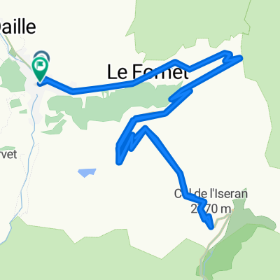
Overview
About this route
a dream trail from Val d´Isere around Lac du Chevril
- -:--
- Duration
- 5.3 km
- Distance
- 317 m
- Ascent
- 72 m
- Descent
- ---
- Avg. speed
- ---
- Avg. speed
Route quality
Waytypes & surfaces along the route
Waytypes
Path
4.9 km
(93 %)
Access road
0.3 km
(5 %)
Surfaces
Paved
0.2 km
(4 %)
Unpaved
0 km
(<1 %)
Asphalt
0.2 km
(4 %)
Ground
0 km
(<1 %)
Undefined
5 km
(95 %)
Continue with Bikemap
Use, edit, or download this cycling route
You would like to ride JUST A DREAM TRAIL or customize it for your own trip? Here is what you can do with this Bikemap route:
Free features
- Save this route as favorite or in collections
- Copy & plan your own version of this route
- Sync your route with Garmin or Wahoo
Premium features
Free trial for 3 days, or one-time payment. More about Bikemap Premium.
- Navigate this route on iOS & Android
- Export a GPX / KML file of this route
- Create your custom printout (try it for free)
- Download this route for offline navigation
Discover more Premium features.
Get Bikemap PremiumFrom our community
Other popular routes starting in Val d'Isère
 2017-08-12 / Col de l'Iseran, toit du sėjour !
- Distance
- 65.9 km
- Ascent
- 1,460 m
- Descent
- 1,477 m
- Location
- Val d'Isère, Auvergne-Rhône-Alpes, France
 021 - 2014
- Distance
- 68.9 km
- Ascent
- 1,825 m
- Descent
- 2,036 m
- Location
- Val d'Isère, Auvergne-Rhône-Alpes, France
 Val D'Isere - Col d'Iseran - Col du Mont Cenis
- Distance
- 65.1 km
- Ascent
- 1,563 m
- Descent
- 1,917 m
- Location
- Val d'Isère, Auvergne-Rhône-Alpes, France
 Lanslevillard - Susa
- Distance
- 66.3 km
- Ascent
- 1,407 m
- Descent
- 2,382 m
- Location
- Val d'Isère, Auvergne-Rhône-Alpes, France
 Col de l'ISeran
- Distance
- 40.9 km
- Ascent
- 1,213 m
- Descent
- 1,209 m
- Location
- Val d'Isère, Auvergne-Rhône-Alpes, France
 Route to Col de L'Iseran
- Distance
- 5.2 km
- Ascent
- 964 m
- Descent
- 0 m
- Location
- Val d'Isère, Auvergne-Rhône-Alpes, France
 AlpenTour2018_E4-8
- Distance
- 120.2 km
- Ascent
- 2,610 m
- Descent
- 3,066 m
- Location
- Val d'Isère, Auvergne-Rhône-Alpes, France
 3-Tag_ValD-isere-Valloire
- Distance
- 114.3 km
- Ascent
- 1,895 m
- Descent
- 2,305 m
- Location
- Val d'Isère, Auvergne-Rhône-Alpes, France
Open it in the app