

ER_MTB
A cycling route starting in Pettendorf, Bavaria, Germany.
Overview
About this route
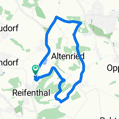
ER-Testroute MTB
- -:--
- Duration
- 8.9 km
- Distance
- 223 m
- Ascent
- 222 m
- Descent
- ---
- Avg. speed
- ---
- Avg. speed

Route quality
Waytypes & surfaces along the route
Waytypes
Track
4.5 km
(50 %)
Road
2.3 km
(26 %)
Surfaces
Paved
3.1 km
(35 %)
Unpaved
4.5 km
(50 %)
Asphalt
3.1 km
(35 %)
Gravel
2.3 km
(26 %)
Continue with Bikemap
Use, edit, or download this cycling route
You would like to ride ER_MTB or customize it for your own trip? Here is what you can do with this Bikemap route:
Free features
- Save this route as favorite or in collections
- Copy & plan your own version of this route
- Sync your route with Garmin or Wahoo
Premium features
Free trial for 3 days, or one-time payment. More about Bikemap Premium.
- Navigate this route on iOS & Android
- Export a GPX / KML file of this route
- Create your custom printout (try it for free)
- Download this route for offline navigation
Discover more Premium features.
Get Bikemap PremiumFrom our community
Other popular routes starting in Pettendorf
 Winzerer Höhen II - Adlersberg - Etterzhausen - Kamelbuckel
- Distance
- 16.8 km
- Ascent
- 397 m
- Descent
- 397 m
- Location
- Pettendorf, Bavaria, Germany
 Reifenthal-Brunn-Reifenthal
- Distance
- 36.9 km
- Ascent
- 578 m
- Descent
- 615 m
- Location
- Pettendorf, Bavaria, Germany
 Regensburger Schmankerl Runde
- Distance
- 52.4 km
- Ascent
- 701 m
- Descent
- 700 m
- Location
- Pettendorf, Bavaria, Germany
 Falkenstein Gravelbike
- Distance
- 51.3 km
- Ascent
- 669 m
- Descent
- 504 m
- Location
- Pettendorf, Bavaria, Germany
 ER_Strecke Tour
- Distance
- 8.1 km
- Ascent
- 129 m
- Descent
- 131 m
- Location
- Pettendorf, Bavaria, Germany
 Testtour Adlersberg-Rgbg-Adlersberg
- Distance
- 20.8 km
- Ascent
- 396 m
- Descent
- 403 m
- Location
- Pettendorf, Bavaria, Germany
 ER_MTB
- Distance
- 8.9 km
- Ascent
- 223 m
- Descent
- 222 m
- Location
- Pettendorf, Bavaria, Germany
 Pettendorf 2 - Mariaort
- Distance
- 16.8 km
- Ascent
- 211 m
- Descent
- 211 m
- Location
- Pettendorf, Bavaria, Germany
Open it in the app