

Randen Bike Tour Variante 2
A cycling route starting in Lottstetten, Baden-Württemberg, Germany.
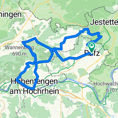
Overview
About this route
Abwechslungsreiche Mountainbiketour über den Randen zum Hagenturm. Es sind eine Single-Trails zu fahren.
- -:--
- Duration
- 51.6 km
- Distance
- 864 m
- Ascent
- 864 m
- Descent
- ---
- Avg. speed
- ---
- Avg. speed
Route quality
Waytypes & surfaces along the route
Waytypes
Track
34.7 km
(67 %)
Quiet road
8.7 km
(17 %)
Surfaces
Paved
12.6 km
(24 %)
Unpaved
24 km
(46 %)
Gravel
14.1 km
(27 %)
Asphalt
12 km
(23 %)
Continue with Bikemap
Use, edit, or download this cycling route
You would like to ride Randen Bike Tour Variante 2 or customize it for your own trip? Here is what you can do with this Bikemap route:
Free features
- Save this route as favorite or in collections
- Copy & plan your own version of this route
- Sync your route with Garmin or Wahoo
Premium features
Free trial for 3 days, or one-time payment. More about Bikemap Premium.
- Navigate this route on iOS & Android
- Export a GPX / KML file of this route
- Create your custom printout (try it for free)
- Download this route for offline navigation
Discover more Premium features.
Get Bikemap PremiumFrom our community
Other popular routes starting in Lottstetten
 Nizi-obzi-Trainingstour
- Distance
- 45.3 km
- Ascent
- 765 m
- Descent
- 728 m
- Location
- Lottstetten, Baden-Württemberg, Germany
 Eglisau - Rorbas - Buch a.Irchel - Dorf - Flaach
- Distance
- 40.5 km
- Ascent
- 606 m
- Descent
- 606 m
- Location
- Lottstetten, Baden-Württemberg, Germany
 6-0_Rafz-Basel 94 km
- Distance
- 93.6 km
- Ascent
- 107 m
- Descent
- 268 m
- Location
- Lottstetten, Baden-Württemberg, Germany
 Tour in den Schwarzwald
- Distance
- 102.1 km
- Ascent
- 1,071 m
- Descent
- 1,071 m
- Location
- Lottstetten, Baden-Württemberg, Germany
 Lottstetten to Stein am Rhein. Bussingen for coffee
- Distance
- 32.9 km
- Ascent
- 159 m
- Descent
- 200 m
- Location
- Lottstetten, Baden-Württemberg, Germany
 Randen Bike Tour Variante 1
- Distance
- 55.6 km
- Ascent
- 762 m
- Descent
- 762 m
- Location
- Lottstetten, Baden-Württemberg, Germany
 Bikerunde zum Aufwärmen
- Distance
- 25.8 km
- Ascent
- 489 m
- Descent
- 489 m
- Location
- Lottstetten, Baden-Württemberg, Germany
 Rafz - Octavo
- Distance
- 61.6 km
- Ascent
- 230 m
- Descent
- 233 m
- Location
- Lottstetten, Baden-Württemberg, Germany
Open it in the app