

Haugastol - Finse
A cycling route starting in Geilo, Buskerud, Norway.
Overview
About this route
Rallarvegen
- -:--
- Duration
- 30.4 km
- Distance
- 383 m
- Ascent
- 303 m
- Descent
- ---
- Avg. speed
- 1,217 m
- Avg. speed

Route quality
Waytypes & surfaces along the route
Waytypes
Access road
15.1 km
(50 %)
Cycleway
11.9 km
(39 %)
Surfaces
Paved
1.1 km
(4 %)
Unpaved
18.8 km
(62 %)
Gravel
15.6 km
(51 %)
Unpaved (undefined)
3.2 km
(11 %)
Continue with Bikemap
Use, edit, or download this cycling route
You would like to ride Haugastol - Finse or customize it for your own trip? Here is what you can do with this Bikemap route:
Free features
- Save this route as favorite or in collections
- Copy & plan your own version of this route
- Sync your route with Garmin or Wahoo
Premium features
Free trial for 3 days, or one-time payment. More about Bikemap Premium.
- Navigate this route on iOS & Android
- Export a GPX / KML file of this route
- Create your custom printout (try it for free)
- Download this route for offline navigation
Discover more Premium features.
Get Bikemap PremiumFrom our community
Other popular routes starting in Geilo
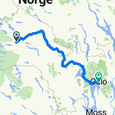 gelio oslo
- Distance
- 250.2 km
- Ascent
- 361 m
- Descent
- 345 m
- Location
- Geilo, Buskerud, Norway
 Rallarvegen: Haugastøl - Flåm
- Distance
- 77.4 km
- Ascent
- 1,800 m
- Descent
- 2,787 m
- Location
- Geilo, Buskerud, Norway
 Rallarvegen 2000
- Distance
- 103.8 km
- Ascent
- 659 m
- Descent
- 1,430 m
- Location
- Geilo, Buskerud, Norway
 Rallarvegen: Haugastøl - Flåm
- Distance
- 74.1 km
- Ascent
- 2,119 m
- Descent
- 3,106 m
- Location
- Geilo, Buskerud, Norway
 Rallarvegen: Haugastøl - Flåm
- Distance
- 14.4 km
- Ascent
- 783 m
- Descent
- 613 m
- Location
- Geilo, Buskerud, Norway
 Rallarvegen: Haugastøl - Flåm
- Distance
- 77.4 km
- Ascent
- 1,800 m
- Descent
- 2,787 m
- Location
- Geilo, Buskerud, Norway
 Rallarvegen from Haugastol to Flåm
- Distance
- 78.2 km
- Ascent
- 1,051 m
- Descent
- 1,794 m
- Location
- Geilo, Buskerud, Norway
 geilo naar Larvik
- Distance
- 274.7 km
- Ascent
- 690 m
- Descent
- 1,450 m
- Location
- Geilo, Buskerud, Norway
Open it in the app