

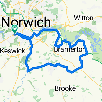
Norwich, Intwood, East Carleton, Wymondham, High Green, Hethersett, High Green, Colney, UEA, Norwich
A cycling route starting in Cringleford, England, United Kingdom.
Overview
About this route
Norwich, Intwood, East Carleton, Wymondham, High Green, Hethersett, High Green, Colney, UEA, Norwich
- -:--
- Duration
- 34.4 km
- Distance
- 135 m
- Ascent
- 135 m
- Descent
- ---
- Avg. speed
- ---
- Avg. speed

Route quality
Waytypes & surfaces along the route
Waytypes
Road
17 km
(49 %)
Quiet road
8.7 km
(25 %)
Surfaces
Paved
15.2 km
(44 %)
Unpaved
0.1 km
(<1 %)
Asphalt
13.7 km
(40 %)
Paved (undefined)
1.4 km
(4 %)
Continue with Bikemap
Use, edit, or download this cycling route
You would like to ride Norwich, Intwood, East Carleton, Wymondham, High Green, Hethersett, High Green, Colney, UEA, Norwich or customize it for your own trip? Here is what you can do with this Bikemap route:
Free features
- Save this route as favorite or in collections
- Copy & plan your own version of this route
- Sync your route with Garmin or Wahoo
Premium features
Free trial for 3 days, or one-time payment. More about Bikemap Premium.
- Navigate this route on iOS & Android
- Export a GPX / KML file of this route
- Create your custom printout (try it for free)
- Download this route for offline navigation
Discover more Premium features.
Get Bikemap PremiumFrom our community
Other popular routes starting in Cringleford
 10 miles from NR4
- Distance
- 15.9 km
- Ascent
- 54 m
- Descent
- 54 m
- Location
- Cringleford, England, United Kingdom
 Newmarket Road 135 to Newmarket Road 137
- Distance
- 40.5 km
- Ascent
- 242 m
- Descent
- 248 m
- Location
- Cringleford, England, United Kingdom
 half marathon lap 1/2
- Distance
- 11.7 km
- Ascent
- 60 m
- Descent
- 60 m
- Location
- Cringleford, England, United Kingdom
 Norwich, New Buckenham, Old Buckenham, Shropham, Great Ellingham, Morley St Botolph, Wymondham, Norwich
- Distance
- 65 km
- Ascent
- 178 m
- Descent
- 181 m
- Location
- Cringleford, England, United Kingdom
 31 mile Norwich Mulbarton loop
- Distance
- 50 km
- Ascent
- 197 m
- Descent
- 197 m
- Location
- Cringleford, England, United Kingdom
 Swanton Morrrrrrrley
- Distance
- 56.3 km
- Ascent
- 209 m
- Descent
- 209 m
- Location
- Cringleford, England, United Kingdom
 Eaton, Forncetts, Goodies, Saxlinghams
- Distance
- 53.7 km
- Ascent
- 163 m
- Descent
- 163 m
- Location
- Cringleford, England, United Kingdom
 33 mile Norwich Horning loop
- Distance
- 53.4 km
- Ascent
- 135 m
- Descent
- 136 m
- Location
- Cringleford, England, United Kingdom
Open it in the app