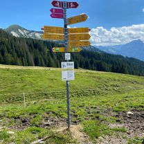
glarus-kerenzer-sargans-gams-wildhaus-wattwil-ricken-glarus
A cycling route starting in Ennenda, Canton of Glarus, Switzerland.
Overview
About this route
wunderschöne rundfahrt, welche über zwei kleine pässchen (kerenzer im glarnerland und ricken im st.gallen) führt. von glarus aus der linth entlang das glarnerland hinunter bis mollis, hoch nach filzbach und wieder hinunter nach murg, dem walensee entlang richtung sargans, am fusse des werdenbergs das rheintal hinunter bis nach grabs, hinauf nach wildhaus (steilster und längster anstieg der tour: von 470müm bis 1070müm also 600hm auf ), durch das schöne toggenburg bis nach wattwil, dann hinauf nach ricken und wieder hinunter bis kaltbrunn, quer über die linthebene bis nach ziegelbrücke und wieder zürück nach glarus.
- -:--
- Duration
- 142.6 km
- Distance
- 1,217 m
- Ascent
- 1,218 m
- Descent
- ---
- Avg. speed
- ---
- Avg. speed
Route quality
Waytypes & surfaces along the route
Waytypes
Busy road
107.5 km
(75 %)
Quiet road
18.9 km
(13 %)
Surfaces
Paved
133.8 km
(94 %)
Unpaved
0.3 km
(<1 %)
Asphalt
132.6 km
(93 %)
Paved (undefined)
0.8 km
(<1 %)
Continue with Bikemap
Use, edit, or download this cycling route
You would like to ride glarus-kerenzer-sargans-gams-wildhaus-wattwil-ricken-glarus or customize it for your own trip? Here is what you can do with this Bikemap route:
Free features
- Save this route as favorite or in collections
- Copy & plan your own version of this route
- Sync your route with Garmin or Wahoo
Premium features
Free trial for 3 days, or one-time payment. More about Bikemap Premium.
- Navigate this route on iOS & Android
- Export a GPX / KML file of this route
- Create your custom printout (try it for free)
- Download this route for offline navigation
Discover more Premium features.
Get Bikemap PremiumFrom our community
Other popular routes starting in Ennenda
 Ennenda Amden Stein Amden Ennenda
- Distance
- 73.3 km
- Ascent
- 2,419 m
- Descent
- 2,432 m
- Location
- Ennenda, Canton of Glarus, Switzerland
 hochzeitsrikscha
- Distance
- 4 km
- Ascent
- 13 m
- Descent
- 12 m
- Location
- Ennenda, Canton of Glarus, Switzerland
 Murgsee - Spanneggsee (VTT)
- Distance
- 5.1 km
- Ascent
- 297 m
- Descent
- 617 m
- Location
- Ennenda, Canton of Glarus, Switzerland
 Projekt 2014 Tag1
- Distance
- 63.5 km
- Ascent
- 1,537 m
- Descent
- 1,553 m
- Location
- Ennenda, Canton of Glarus, Switzerland
 Klausen- Pragelpass
- Distance
- 128.4 km
- Ascent
- 2,711 m
- Descent
- 2,711 m
- Location
- Ennenda, Canton of Glarus, Switzerland
 Glarus-Klausenpass-Glarus
- Distance
- 76.6 km
- Ascent
- 1,453 m
- Descent
- 1,454 m
- Location
- Ennenda, Canton of Glarus, Switzerland
 glarus-filzbach-mühlehorn-niederurnen-glarus
- Distance
- 40.3 km
- Ascent
- 432 m
- Descent
- 432 m
- Location
- Ennenda, Canton of Glarus, Switzerland
 Glarus-Pfäffikon-Rappi-Glarus
- Distance
- 79.9 km
- Ascent
- 277 m
- Descent
- 277 m
- Location
- Ennenda, Canton of Glarus, Switzerland
Open it in the app


